
~ Alexandria VA topo map, 1:24000 scale, 7.5 X 7.5 Minute, 2016
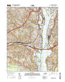
Alexandria, Virginia, USGS topographic map dated 2016.
Includes geographic coordinates (latitude and longitude). This topographic map is suitable for hiking, camping, and exploring, or framing it as a wall map.
Printed on-demand using high resolution imagery, on heavy weight and acid free paper, or alternatively on a variety of synthetic materials.
Topos available on paper, Waterproof, Poly, or Tyvek. Usually shipping rolled, unless combined with other folded maps in one order.
- Product Number: USGS-8290630
- Free digital map download (high-resolution, GeoPDF): Alexandria, Virginia (file size: 27 MB)
- Map Size: please refer to the dimensions of the GeoPDF map above
- Weight (paper map): ca. 55 grams
- Map Type: POD USGS Topographic Map
- Map Series: US Topo
- Map Verison: Current
- Cell ID: 507
- Datum: North American Datum of 1983
- Map Projection: Transverse Mercator
- Map Cell Name: Alexandria
- Grid size: 7.5 X 7.5 Minute
- Date on map: 2016
- Map Scale: 1:24000
- Geographical region: Virginia, United States
Neighboring Maps:
All neighboring USGS topo maps are available for sale online at a variety of scales.
Spatial coverage:
Topo map Alexandria, Virginia, covers the geographical area associated the following places:
- Fort Barnard Heights - College Park - Aurora Hills - Villamay - Buzzard Point - Wakefield - Indian Queen Estates - Bucknell Heights - Dalecrest - Wellington Heights - Penn Daw Village - Fort Foote Village - Duke Gardens - Alexandria - Arna Valley - Beverley Hills - Parkglen - Rose Hill Farms - Clermont Woods - Brad Lee - Claremont - Arlington Village - Columbia Forest - Chinquapin Village - Buckingham - Rose Hill - Jefferson Park - Arlington Heights - Monticello Park - Brooke Manor - Cameron Valley - Delta - Clover - Chapel Hill - Bellevue - Mount Ida - Shirlington - Westgrove - Wilton Woods - Piney Court - Memorial Heights - Washington Forest - Virginia Heights - Westmont - Arlington Forest - Groveton - Virginia Hills - Cannon - Ridgeview - Braddock - Giesboro - Hollin Hills - Fair Haven - Rosemont - Hollindale - Belle View - Governors Grove - Del Ray - North Potomac Vista - Arlandria - Huntington - Bucknell Manor - Kerby Hill - Varsity Park - Oak Park - Addison Heights - Congress Heights - Parkfairfax - Bush Hill Woods - River Ridge Estates - Burgundy Village - Brookville - Oakcrest - Fort Ward Heights - Penn Daw - Potomac Vista - Virginia Highlands - Braddock Heights - New Alexandria - Belle Haven - Spring Bank - Barcroft - North Fairlington - East Arlington (historical) - Woodley Hills - Jefferson Manor - Marlin Forest - Seminary Valley - Saint Elmo - Shirley Duke - White Oaks - Warwick Village - Green Valley - Lynhaven - Groveton Heights - Columbia Heights - New Glatz - South Fairlington - Winslow Hills - River Bend Estates
- Map Area ID: AREA38.87538.75-77.125-77
- Northwest corner Lat/Long code: USGSNW38.875-77.125
- Northeast corner Lat/Long code: USGSNE38.875-77
- Southwest corner Lat/Long code: USGSSW38.75-77.125
- Southeast corner Lat/Long code: USGSSE38.75-77
- Northern map edge Latitude: 38.875
- Southern map edge Latitude: 38.75
- Western map edge Longitude: -77.125
- Eastern map edge Longitude: -77


