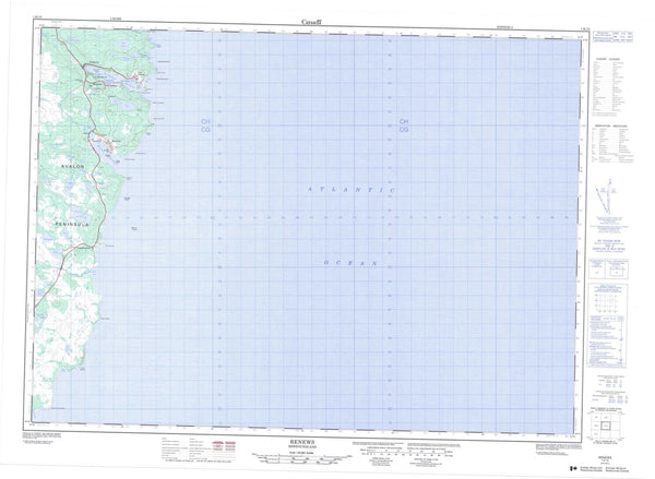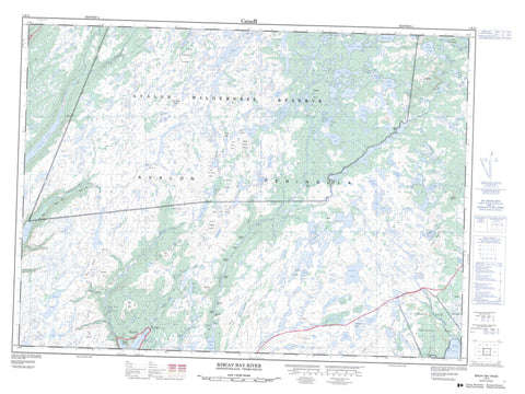
001K14 Biscay Bay River Canada topo map, 1:50,000 scale
001K14 Biscay Bay River NRCAN topographic map.
Includes UTM and GPS geographic coordinates (latitude and longitude). This 50k scale map is suitable for hiking, camping, and exploring, or you could frame it as a wall map.
Printed on-demand using high resolution, on heavy weight and acid free paper, or as an upgrade on a variety of synthetic materials.
Topos available on paper, Waterproof, Poly, or Tyvek. Usually shipping rolled, unless combined with other folded maps in one order.
- Product Number: NRCAN-001K14
- Parent Topo: TOPO-001K
- Map ID also known as: 001K14, 01K14, 1K14
- Unfolded Size: Approximately 26" high by 36" wide
- Weight (paper map): ca. 55 grams
- Map Type: POD NRCAN Topographic Map
- Map Scale: 1:50,000
- Geographical region: Newfoundland and Labrador, Canada
Neighboring Maps:
All neighboring Canadian topo maps are available for sale online at 1:50,000 scale.
Purchase the smaller scale map covering this area: Topo-001K
Spatial coverage:
Topo map sheet 001K14 Biscay Bay River covers the following places:
- Chance Cove - Hallerans Cove - Northeast Arm - Northwest Arm - Pound Cove - Trepassey Bay - Trepassey Harbour - Avalon Peninsula - Chidleys Falls - Governor Allardyce Falls - Lady Allardyce Falls - Browsey Island - Chidleys Island - Nagles Island - Seven Islands - Watsons Island - Backwaters - Bear Hill Pond - Beaver Pond - Big Bold-Face Pond - Big Bough Place - Big Butterpot - Big Glen Pond - Big Island Pond - Big Pond - Big Pond Under The Hill - Billy Gatheralls Pond - Billy Joes Pond - Biscay Bay Pond - Black Duck Pond - Black River Ponds - Black Rock Pond - Blackwood Ponds - Bloody Pond - Bretts Pond - Broosey Island Pond - Browsey Island Pond - Burnt Wood Pond - Butterpot Pond - Byrnes Pond - Carew Gully - Chidleys Ponds - Clam Pond - Clancy Pond - Clarkes Pond - Cook's Pond - Coxes Well - Coxes Well Upper - Crooked Ponds - Crops Pond - Cross Cats Pond - Cross Cut Pond - Cullotens Pond - Debbie Poors Pond - Doctors Pond - Dog Pond - Fifth Pond - First Pond - First Pond - Flahertys Hill Pond - Follies Pond - Fourth Pond - Fox Pond - Goose Ponds - Grinders Hill Ponds - Gull Pond - Gull Pond - Gull Pond - Gull Pond - Guns Pond - Guss Pond - Hatchet Pond - Hatchet Pond - Hatchet Rock Pond - Hell Fire Pond - Hollies Pond - Holyrood Pond - Island Pond - Island Pond - Jays Pond - Jones Pond - Kennedys Pond - Laden Fields Pond - Laden Fields Ponds - Lesters Pond - Little Bold-Face Pond - Little Bough Place - Little Butterpot - Little Glen Pond - Long Pond - Long Pond - Long Pond - Long Pond of the Back River - Low Pond - Lynx Pond - Merigans Pond - Middle Pond - Miller's Pond - Molleys Gullies - Monts Pond - Mount Misery Pond - Mulberry Pond - Murphys Pond - Mussel Pond - New Pond - Northwest Pond - Northwest Pond - Northwest Pond - Old Woman's Pond - Organs Pond - Otter Pond - Paddy Reddys Pond - Passage Pond - Peters Pond - Ponds On The River - Randy Boo Pond - Randys Pond - Renewsmens Pond - River Head Pond - Riverhead Pond - Rocky Downs Pond - Round Pond - Saddle Pond - Saunders Pond - Saunders Pond - Second Pond - Shorts Pond - Sixth Pond - Sparks Pond - Stage Pond - Stephen's Pond - Stevens Pond - Stockes Pond - Three Corner Pond - Three Corner Pond - Tilt Pond - Tocher's Pond - Tom Dinns Pond - Travellers Pond - Trout Ponds - Trout Ponds - Tucken Bush Pond - Tuckens Gully - Wobble Pond - Bear Hill - Big Lookout - Big Stoney Ridge - Brazils Rock - Butter Pot - Chidleys Ridge - Doctor Baulds Lookout - Green Hills - Grinders Hill - Little Stoney Ridge - Long Hill - Long Ridge - Lower Drop - Middle Drop - Millers Hills - Mount Misery - Pitchs Lookout - Red Hill - The Lookout - The Neck - Tims Crossing Place - Tims Hill - Upper Drop - Avalon Wilderness Reserve - Chance Cove Provincial Park - Ambies Brook - Back Brook - Bar River - Beaton Brook - Beaver Pond River - Big Drop River - Biscay Bay River - Black River - Chance Cove Brook - Chidleys River - Cootes Pond River - Crossing Place River - Harrys Brook - Laden Field's Brook - Mars Brook - Mount Misery River - Mussel Brook - Northeast Brook - Northwest Brook - Old Woman's Brook - Peter's River - Portugal Cove Brook - Redmans River - Riverhead River - St. Shotts River - Stoney River - Tochers Brook - Beachy Pool - Chidleys Pool - Crooked Pool - Deer Crossing - Lady Allardyce Pool - Rennies Pool - Sandy Pool - Watsons Pool - Whale Back - Winters Pool - Bobbys Rock - Flat Rocks - Hornet Rock - Paddock Shoal - Slidin Rocks - Fermeuse - Daniel's Point - Riverhead - Shoal Point - Hansers Break - Little Juniper Break - Long Marsh - Three Corner Pond Break - Tochers Drook - Beaver Pond Bottom - Black Bottom - Burnt Knap - Gull Pond Bottom - Quakers Meadow - Shoe Cove Marshes - The Meadow - Western Bottom