
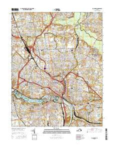
~ Richmond VA topo map, 1:24000 scale, 7.5 X 7.5 Minute, 2016
Richmond, Virginia, USGS topographic map dated 2016.
Includes geographic coordinates (latitude and longitude). This topographic map is suitable for hiking, camping, and exploring, or framing it as a wall map.
Printed on-demand using high resolution imagery, on heavy weight and acid free paper, or alternatively on a variety of synthetic materials.
Topos available on paper, Waterproof, Poly, or Tyvek. Usually shipping rolled, unless combined with other folded maps in one order.
- Product Number: USGS-8288154
- Free digital map download (high-resolution, GeoPDF): Richmond, Virginia (file size: 27 MB)
- Map Size: please refer to the dimensions of the GeoPDF map above
- Weight (paper map): ca. 55 grams
- Map Type: POD USGS Topographic Map
- Map Series: US Topo
- Map Verison: Current
- Cell ID: 37833
- Datum: North American Datum of 1983
- Map Projection: Transverse Mercator
- Map Cell Name: Richmond
- Grid size: 7.5 X 7.5 Minute
- Date on map: 2016
- Map Scale: 1:24000
- Geographical region: Virginia, United States
Neighboring Maps:
All neighboring USGS topo maps are available for sale online at a variety of scales.
Spatial coverage:
Topo map Richmond, Virginia, covers the geographical area associated the following places:
- Windy Hill Estates - Chickahominy - Church Hill - Lynn Grove - Church Hill - Acca - Montrose Heights - Fayette Park - Ginter Park - Richmond - Central Gardens - Montrose - Highland Park - Woodland Park - Cloverland - Ellerson - Mayfield Farms - Chestnut Hill - Mobile Towne Mobile Home Park - Brook Hill - Oak Hill - Greendale - Glenwood Farms - Mayfair Place - Lower Rocketts - Springdale - Manchester - Westover Hills - South Richmond - Rocketts - Lakeside - Dumbarton - Windsor Farms - Washington Park - East Highland Park
- Map Area ID: AREA37.62537.5-77.5-77.375
- Northwest corner Lat/Long code: USGSNW37.625-77.5
- Northeast corner Lat/Long code: USGSNE37.625-77.375
- Southwest corner Lat/Long code: USGSSW37.5-77.5
- Southeast corner Lat/Long code: USGSSE37.5-77.375
- Northern map edge Latitude: 37.625
- Southern map edge Latitude: 37.5
- Western map edge Longitude: -77.5
- Eastern map edge Longitude: -77.375


