
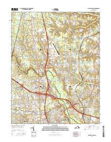
~ Yellow Tavern VA topo map, 1:24000 scale, 7.5 X 7.5 Minute, 2016
Yellow Tavern, Virginia, USGS topographic map dated 2016.
Includes geographic coordinates (latitude and longitude). This topographic map is suitable for hiking, camping, and exploring, or framing it as a wall map.
Printed on-demand using high resolution imagery, on heavy weight and acid free paper, or alternatively on a variety of synthetic materials.
Topos available on paper, Waterproof, Poly, or Tyvek. Usually shipping rolled, unless combined with other folded maps in one order.
- Product Number: USGS-8264006
- Free digital map download (high-resolution, GeoPDF): Yellow Tavern, Virginia (file size: 26 MB)
- Map Size: please refer to the dimensions of the GeoPDF map above
- Weight (paper map): ca. 55 grams
- Map Type: POD USGS Topographic Map
- Map Series: US Topo
- Map Verison: Current
- Cell ID: 50083
- Datum: North American Datum of 1983
- Map Projection: Transverse Mercator
- Map Cell Name: Yellow Tavern
- Grid size: 7.5 X 7.5 Minute
- Date on map: 2016
- Map Scale: 1:24000
- Geographical region: Virginia, United States
Neighboring Maps:
All neighboring USGS topo maps are available for sale online at a variety of scales.
Spatial coverage:
Topo map Yellow Tavern, Virginia, covers the geographical area associated the following places:
- Greenwood - Kosmo Village Mobile Home Park - Woodman Terrace - Schrader Woods - Kingswood Court - Lewistown - Hanover Heights South - Rapidan Woods - Chamberlayne - Poindexters - Patrick Henry Heights - North Run Estates - Pottomoi - Totopotomoy - Yellow Tavern - Craney Island Estates - Mimosa Hills - Hanover Heights - Ashcake - Gwathmey - Stonewall Manor - Knollwood - Mount Hermon Heights - Kings Charter - Sharon Park - Atlee Manor - Northfield - Atlee - Blue Star Estates - Burnside Farms - Chamberlayne Farms - Stony Run Estates - Holly Ridge - Forest Lake Hills - Atlee Station - Beechwood Farms - Huntington Heights - Solomons Store - Saint Josephs Villa - Laurel Park - Longdale - Heaths Store - Biltmore - Cedar Lane - Colonial Estates Trailer Park - Lydell Heights - Mountain Laurel - Lincoln Park - Henry Clay Heights - Hanover Hills - Middleton - Elmont - Stapleton - Twin Oaks - Boudar - Laurel Grove Estates - Atlee Ridge - Holly Glen Estates - Randolph Ridge - Dellwood - Hunton - Laurel West - Northwoods - Pearsons Corner - Quail Walk - Kenwood - Peaks - Slash Cottage - Chamberlayne Heights - French Hay - Brown Grove
- Map Area ID: AREA37.7537.625-77.5-77.375
- Northwest corner Lat/Long code: USGSNW37.75-77.5
- Northeast corner Lat/Long code: USGSNE37.75-77.375
- Southwest corner Lat/Long code: USGSSW37.625-77.5
- Southeast corner Lat/Long code: USGSSE37.625-77.375
- Northern map edge Latitude: 37.75
- Southern map edge Latitude: 37.625
- Western map edge Longitude: -77.5
- Eastern map edge Longitude: -77.375


