
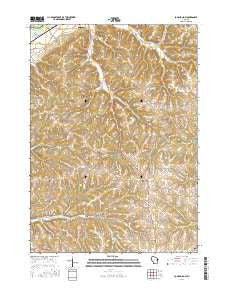
~ Long Hollow WI topo map, 1:24000 scale, 7.5 X 7.5 Minute, 2016
Long Hollow, Wisconsin, USGS topographic map dated 2016.
Includes geographic coordinates (latitude and longitude). This topographic map is suitable for hiking, camping, and exploring, or framing it as a wall map.
Printed on-demand using high resolution imagery, on heavy weight and acid free paper, or alternatively on a variety of synthetic materials.
Topos available on paper, Waterproof, Poly, or Tyvek. Usually shipping rolled, unless combined with other folded maps in one order.
- Product Number: USGS-8214790
- Free digital map download (high-resolution, GeoPDF): Long Hollow, Wisconsin (file size: 26 MB)
- Map Size: please refer to the dimensions of the GeoPDF map above
- Weight (paper map): ca. 55 grams
- Map Type: POD USGS Topographic Map
- Map Series: US Topo
- Map Verison: Current
- Cell ID: 70738
- Datum: North American Datum of 1983
- Map Projection: Transverse Mercator
- Map Cell Name: Long Hollow
- Grid size: 7.5 X 7.5 Minute
- Date on map: 2016
- Map Scale: 1:24000
- Geographical region: Wisconsin, United States
Neighboring Maps:
All neighboring USGS topo maps are available for sale online at a variety of scales.
Spatial coverage:
Topo map Long Hollow, Wisconsin, covers the geographical area associated the following places:
- Switzer Cemetery - Plum School (historical) - Bethel Cemetery - Hickory Grove Country Club - Crooked Creek School (historical) - Spring Valley - Salzgeber Quarry - Brindley School (historical) - G and M Farms - Plum Valley - Trumm Farm - Breezy Point School (historical) - Munn Hollow - Marion Church - T C Farms - Schwitzer School (historical) - Leffler Farm - Town of Marion - Pine Knob - Brechler School (historical) - Walker Corner - Martin Farms - Long Hollow - Brechler Cemetery - Meadow Brook Farm - Butternut Hollow - Adkins Ridge - Round S Dairy - Latham Farms - Fisher Hollow - Crown Hill Cemetery - Rogers School (historical)
- Map Area ID: AREA43.12543-90.75-90.625
- Northwest corner Lat/Long code: USGSNW43.125-90.75
- Northeast corner Lat/Long code: USGSNE43.125-90.625
- Southwest corner Lat/Long code: USGSSW43-90.75
- Southeast corner Lat/Long code: USGSSE43-90.625
- Northern map edge Latitude: 43.125
- Southern map edge Latitude: 43
- Western map edge Longitude: -90.75
- Eastern map edge Longitude: -90.625


