
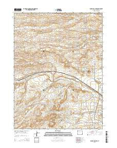
~ Round Top Lake WY topo map, 1:24000 scale, 7.5 X 7.5 Minute, 2015
Round Top Lake, Wyoming, USGS topographic map dated 2015.
Includes geographic coordinates (latitude and longitude). This topographic map is suitable for hiking, camping, and exploring, or framing it as a wall map.
Printed on-demand using high resolution imagery, on heavy weight and acid free paper, or alternatively on a variety of synthetic materials.
Topos available on paper, Waterproof, Poly, or Tyvek. Usually shipping rolled, unless combined with other folded maps in one order.
- Product Number: USGS-7862479
- Free digital map download (high-resolution, GeoPDF): Round Top Lake, Wyoming (file size: 18 MB)
- Map Size: please refer to the dimensions of the GeoPDF map above
- Weight (paper map): ca. 55 grams
- Map Type: POD USGS Topographic Map
- Map Series: US Topo
- Map Verison: Current
- Cell ID: 38768
- Datum: North American Datum of 1983
- Map Projection: Transverse Mercator
- Map Cell Name: Round Top Lake
- Grid size: 7.5 X 7.5 Minute
- Date on map: 2015
- Map Scale: 1:24000
- Geographical region: Wyoming, United States
Neighboring Maps:
All neighboring USGS topo maps are available for sale online at a variety of scales.
Spatial coverage:
Topo map Round Top Lake, Wyoming, covers the geographical area associated the following places:
- Shellback - Corriedale Ranch - Bell Number 25 Well - Koppes Number 1 Well - Koppes Number 4 Well - Bell Number 16 Well - Bell Number 10 Well - Bell Number 5 Well - Happy Jack Number 1 Well - KKTU-TV (Cheyenne) - Bell Number 14 Well - King Number 2 Well - Eddy Well - Experiment Station Dam - Bailey Number 5 Well - John W Griffen Dam - High Plains Grasslands Research Station - Elkar Number 3 Well - Bell Number 24 Well - Happy Jack Number 3 Well - Bell Number 6 Well - Bell Number 12 Well - Wyoming Angus Ranch - King Reservoir - John W Griffen Reservoir - Bell Number 15 Well - Round Top Lake - Meadowlark Ranch - Bell Number 8 Well - Holman Well - Equalizing Reservoir - Fred Hersig Reservoir - Happy Jack Number 2 Well - Elkar Number 1 Well - Fred Hersig Dam - King Number 4 Well - Koppes Number 2 Well - Round Top - Spring Creek - Koppes Number 3 Well - Shell Back Ranch - Bell Number 17 Well - Bailey Number 1 Well - Bell Number 11 Well - Bell Ranch - Carpenter Mill Camp
- Map Area ID: AREA41.2541.125-105-104.875
- Northwest corner Lat/Long code: USGSNW41.25-105
- Northeast corner Lat/Long code: USGSNE41.25-104.875
- Southwest corner Lat/Long code: USGSSW41.125-105
- Southeast corner Lat/Long code: USGSSE41.125-104.875
- Northern map edge Latitude: 41.25
- Southern map edge Latitude: 41.125
- Western map edge Longitude: -105
- Eastern map edge Longitude: -104.875


