
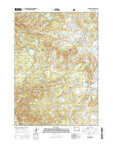
~ Raid Lake WY topo map, 1:24000 scale, 7.5 X 7.5 Minute, 2015
Raid Lake, Wyoming, USGS topographic map dated 2015.
Includes geographic coordinates (latitude and longitude). This topographic map is suitable for hiking, camping, and exploring, or framing it as a wall map.
Printed on-demand using high resolution imagery, on heavy weight and acid free paper, or alternatively on a variety of synthetic materials.
Topos available on paper, Waterproof, Poly, or Tyvek. Usually shipping rolled, unless combined with other folded maps in one order.
- Product Number: USGS-7862039
- Free digital map download (high-resolution, GeoPDF): Raid Lake, Wyoming (file size: 27 MB)
- Map Size: please refer to the dimensions of the GeoPDF map above
- Weight (paper map): ca. 55 grams
- Map Type: POD USGS Topographic Map
- Map Series: US Topo
- Map Verison: Current
- Cell ID: 36910
- Datum: North American Datum of 1983
- Map Projection: Transverse Mercator
- Map Cell Name: Raid Lake
- Grid size: 7.5 X 7.5 Minute
- Date on map: 2015
- Map Scale: 1:24000
- Geographical region: Wyoming, United States
Neighboring Maps:
All neighboring USGS topo maps are available for sale online at a variety of scales.
Spatial coverage:
Topo map Raid Lake, Wyoming, covers the geographical area associated the following places:
- Monroe Lake - Willow Basin - Sage Basin Trail - Pine Island Lake - Mitchells Nipple - Whisky Creek - Silver Lake - Raid Lake - Cottonwood Trail - Chilcoot Trail - Sylvan Creek - Lower Sylvan Lake - Warbonnet Lake - Sylvan Lake Trail - Raid Creek - Scab Lake - Dream Lake Trail - Bobs Lake - Lightning Lakes - Jessie Lake - Halls Creek - Divide Dam - South Fork Silver Creek - Middle Fork Boulder Creek - Silver Lake - Star Creek - Divide Reservoir - Crescent Lake - Divide Lake - Sheep Creek - South Fork Lake - Wolf Lake - Toboggan Lake - Cross Lake - Lowline Trail - Upper Silver Lakes - Silver Lake Trail - Three Elk Lake - Dream Creek - Little Divide Lake - Monroe Creek - Knob Lakes - South Fork Boulder Creek - Shoestring Lake - Junction Lake - Upper Sylvan Lake - North Fork Silver Creek - Silver Lake Dam - Full Moon Lake - Silver Creek Canyon - Scab Sage Trail - Star Lake - Scab Creek Trail - Moose Lake - Dream Lake
- Map Area ID: AREA42.87542.75-109.5-109.375
- Northwest corner Lat/Long code: USGSNW42.875-109.5
- Northeast corner Lat/Long code: USGSNE42.875-109.375
- Southwest corner Lat/Long code: USGSSW42.75-109.5
- Southeast corner Lat/Long code: USGSSE42.75-109.375
- Northern map edge Latitude: 42.875
- Southern map edge Latitude: 42.75
- Western map edge Longitude: -109.5
- Eastern map edge Longitude: -109.375


