
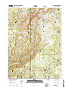
~ Medicine Bow Peak WY topo map, 1:24000 scale, 7.5 X 7.5 Minute, 2015
Medicine Bow Peak, Wyoming, USGS topographic map dated 2015.
Includes geographic coordinates (latitude and longitude). This topographic map is suitable for hiking, camping, and exploring, or framing it as a wall map.
Printed on-demand using high resolution imagery, on heavy weight and acid free paper, or alternatively on a variety of synthetic materials.
Topos available on paper, Waterproof, Poly, or Tyvek. Usually shipping rolled, unless combined with other folded maps in one order.
- Product Number: USGS-7861031
- Free digital map download (high-resolution, GeoPDF): Medicine Bow Peak, Wyoming (file size: 25 MB)
- Map Size: please refer to the dimensions of the GeoPDF map above
- Weight (paper map): ca. 55 grams
- Map Type: POD USGS Topographic Map
- Map Series: US Topo
- Map Verison: Current
- Cell ID: 28652
- Datum: North American Datum of 1983
- Map Projection: Transverse Mercator
- Map Cell Name: Medicine Bow Peak
- Grid size: 7.5 X 7.5 Minute
- Date on map: 2015
- Map Scale: 1:24000
- Geographical region: Wyoming, United States
Neighboring Maps:
All neighboring USGS topo maps are available for sale online at a variety of scales.
Spatial coverage:
Topo map Medicine Bow Peak, Wyoming, covers the geographical area associated the following places:
- Hourglass Lake - Hat Park - Keystone Reservoir - Mirror Lake Campground - Silver Lake Campground - Fourlog Park - South Gap Lake - Klondike Lake - Class Lake - Dipper Lake - Keystone Dam - Lake Marie - Silver Lake - Snowy Range - First Enlargement of Wiant Dam - Ryan Brothers Lake Dam - Knapp Lake - Sucker Reservoir - Circle Trail - Telephone Lakes - Lorain Group Mine - Towner Lake - Nelson Park - Mirror Lake - Black Jack Lake - Lost Lake - Browns Peak - Ryan Brothers Lake - Little Brooklyn Lake - Fishhook Lake - Brady Lake - Missouri Lakes - Libby Lake - Lewis Lake Campground - Middle Long Lake - Sucker Lakes Reservoir - Lookout Lake - Libby Flats - Lake Marie Picnic Ground - Lewis Lake - North Twin Lake - Hatchet Lake - Round Lake - South Twin Lake - Heart Lake - Snowy Range Pass - Sucker Dam - Scott Lake - Sugarloaf Recreation Area - Brooklyn Lake - Upper Missouri Lake - Sandy Lake - Headquarters Park - Medicine Bow Peak - Little Brooklyn Lake Dam - Bellamy Lake - Lakes Trail - Sucker Lake - Pinchot Lake - Sugarloaf Mountain - Dipper Lake - Highway 130 Lake - Silverman Lake - Libby Flats Observation Shed - Medicine Bow Trail - Medicine Bow National Forest - Wiant Reservoir - Jeep Lake - Willow Park - Lower Missouri Lake - Wiant Number 2 Dam
- Map Area ID: AREA41.37541.25-106.375-106.25
- Northwest corner Lat/Long code: USGSNW41.375-106.375
- Northeast corner Lat/Long code: USGSNE41.375-106.25
- Southwest corner Lat/Long code: USGSSW41.25-106.375
- Southeast corner Lat/Long code: USGSSE41.25-106.25
- Northern map edge Latitude: 41.375
- Southern map edge Latitude: 41.25
- Western map edge Longitude: -106.375
- Eastern map edge Longitude: -106.25


