
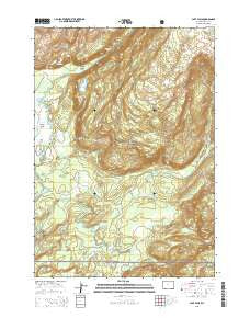
~ Cave Falls WY topo map, 1:24000 scale, 7.5 X 7.5 Minute, 2015
Cave Falls, Wyoming, USGS topographic map dated 2015.
Includes geographic coordinates (latitude and longitude). This topographic map is suitable for hiking, camping, and exploring, or framing it as a wall map.
Printed on-demand using high resolution imagery, on heavy weight and acid free paper, or alternatively on a variety of synthetic materials.
Topos available on paper, Waterproof, Poly, or Tyvek. Usually shipping rolled, unless combined with other folded maps in one order.
- Product Number: USGS-7856386
- Free digital map download (high-resolution, GeoPDF): Cave Falls, Wyoming (file size: 24 MB)
- Map Size: please refer to the dimensions of the GeoPDF map above
- Weight (paper map): ca. 55 grams
- Map Type: POD USGS Topographic Map
- Map Series: US Topo
- Map Verison: Current
- Cell ID: 7717
- Datum: North American Datum of 1983
- Map Projection: Transverse Mercator
- Map Cell Name: Cave Falls
- Grid size: 7.5 X 7.5 Minute
- Date on map: 2015
- Map Scale: 1:24000
- Geographical region: Wyoming, United States
Neighboring Maps:
All neighboring USGS topo maps are available for sale online at a variety of scales.
Spatial coverage:
Topo map Cave Falls, Wyoming, covers the geographical area associated the following places:
- Proposition Creek - Rocky Ford - Ouzel Falls - Bechler River - Birch Hills - Calf Creek Hill - Union Falls Trail - Cascade Corner - Junco Lake - Bechler Canyon - Treasure Island - Rainbow Falls - Iris Falls - Winegar Lake - Ranger Lake - Colonnade Falls - Lake Wyodaho - Mountain Ash Creek - Bechler River Trail - Falls River Basin - Cave Falls - Old Marysville Road - Ouzel Creek - Calf Creek - Fish Lake
- Map Area ID: AREA44.2544.125-111-110.875
- Northwest corner Lat/Long code: USGSNW44.25-111
- Northeast corner Lat/Long code: USGSNE44.25-110.875
- Southwest corner Lat/Long code: USGSSW44.125-111
- Southeast corner Lat/Long code: USGSSE44.125-110.875
- Northern map edge Latitude: 44.25
- Southern map edge Latitude: 44.125
- Western map edge Longitude: -111
- Eastern map edge Longitude: -110.875


