
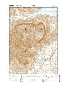
~ Castle Rock Creek WY topo map, 1:24000 scale, 7.5 X 7.5 Minute, 2015
Castle Rock Creek, Wyoming, USGS topographic map dated 2015.
Includes geographic coordinates (latitude and longitude). This topographic map is suitable for hiking, camping, and exploring, or framing it as a wall map.
Printed on-demand using high resolution imagery, on heavy weight and acid free paper, or alternatively on a variety of synthetic materials.
Topos available on paper, Waterproof, Poly, or Tyvek. Usually shipping rolled, unless combined with other folded maps in one order.
- Product Number: USGS-7856378
- Free digital map download (high-resolution, GeoPDF): Castle Rock Creek, Wyoming (file size: 21 MB)
- Map Size: please refer to the dimensions of the GeoPDF map above
- Weight (paper map): ca. 55 grams
- Map Type: POD USGS Topographic Map
- Map Series: US Topo
- Map Verison: Current
- Cell ID: 7598
- Datum: North American Datum of 1983
- Map Projection: Transverse Mercator
- Map Cell Name: Castle Rock Creek
- Grid size: 7.5 X 7.5 Minute
- Date on map: 2015
- Map Scale: 1:24000
- Geographical region: Wyoming, United States
Neighboring Maps:
All neighboring USGS topo maps are available for sale online at a variety of scales.
Spatial coverage:
Topo map Castle Rock Creek, Wyoming, covers the geographical area associated the following places:
- Wapiti Post Office - Bull Creek - Wilson-McKissack Ditch - Castle Rock - East Fork Timber Creek - Castle Rock Ditch - Sheep Creek - Sheep Mountain - Castle Rock Ranch - Castle Rock Creek - Bar Flying E Airport - Trout Creek Ranch - West Fork Timber Creek - Andy Martin Pit - Bull Creek Cemetery - Bear Creek - Stout Ranch - Sheep Mountain - North Fork Shoshone River - Post Creek - Andy Martin Hill - Northfork Pit - Broken H Lodge - Park County Fire Protection District 2 Station 2 - Trout Creek - Neff Ditch
- Map Area ID: AREA44.544.375-109.375-109.25
- Northwest corner Lat/Long code: USGSNW44.5-109.375
- Northeast corner Lat/Long code: USGSNE44.5-109.25
- Southwest corner Lat/Long code: USGSSW44.375-109.375
- Southeast corner Lat/Long code: USGSSE44.375-109.25
- Northern map edge Latitude: 44.5
- Southern map edge Latitude: 44.375
- Western map edge Longitude: -109.375
- Eastern map edge Longitude: -109.25


