
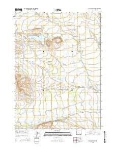
~ Big Piney West WY topo map, 1:24000 scale, 7.5 X 7.5 Minute, 2015
Big Piney West, Wyoming, USGS topographic map dated 2015.
Includes geographic coordinates (latitude and longitude). This topographic map is suitable for hiking, camping, and exploring, or framing it as a wall map.
Printed on-demand using high resolution imagery, on heavy weight and acid free paper, or alternatively on a variety of synthetic materials.
Topos available on paper, Waterproof, Poly, or Tyvek. Usually shipping rolled, unless combined with other folded maps in one order.
- Product Number: USGS-7855806
- Free digital map download (high-resolution, GeoPDF): Big Piney West, Wyoming (file size: 19 MB)
- Map Size: please refer to the dimensions of the GeoPDF map above
- Weight (paper map): ca. 55 grams
- Map Type: POD USGS Topographic Map
- Map Series: US Topo
- Map Verison: Current
- Cell ID: 3797
- Datum: North American Datum of 1983
- Map Projection: Transverse Mercator
- Map Cell Name: Big Piney West
- Grid size: 7.5 X 7.5 Minute
- Date on map: 2015
- Map Scale: 1:24000
- Geographical region: Wyoming, United States
Neighboring Maps:
All neighboring USGS topo maps are available for sale online at a variety of scales.
Spatial coverage:
Topo map Big Piney West, Wyoming, covers the geographical area associated the following places:
- South Piney Ditch - West Channel - South McKay Ditch Number 2 - Spring Creek - Sixty-Seven Reservoir - Deer Hill Draw - Homer Ditch Number 1 - Tarter Ditch - Yankee Ditch - Summit Ditch - Meadow Canyon Swale - Reardon Ditch - Osterhout Edwards Ditch - McNinch Wash - Sixty-Seven Butte - Holden Ditch - Abo Ditch - Sixty-Seven Draw - East Star Corral Oil Field - Plainview Cemetery - Sixty-Seven Reservoir Distribution - Wilson Ditch - H McKay Ditch - Lehmer Ditch - East Channel - Sixty-Seven Reservoir Dam - Homestake Ditch - McNinch Ditch - D B Budd Butte
- Map Area ID: AREA42.62542.5-110.25-110.125
- Northwest corner Lat/Long code: USGSNW42.625-110.25
- Northeast corner Lat/Long code: USGSNE42.625-110.125
- Southwest corner Lat/Long code: USGSSW42.5-110.25
- Southeast corner Lat/Long code: USGSSE42.5-110.125
- Northern map edge Latitude: 42.625
- Southern map edge Latitude: 42.5
- Western map edge Longitude: -110.25
- Eastern map edge Longitude: -110.125


