
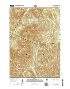
~ Knox Mountain VT topo map, 1:24000 scale, 7.5 X 7.5 Minute, 2015
Knox Mountain, Vermont, USGS topographic map dated 2015.
Includes geographic coordinates (latitude and longitude). This topographic map is suitable for hiking, camping, and exploring, or framing it as a wall map.
Printed on-demand using high resolution imagery, on heavy weight and acid free paper, or alternatively on a variety of synthetic materials.
Topos available on paper, Waterproof, Poly, or Tyvek. Usually shipping rolled, unless combined with other folded maps in one order.
- Product Number: USGS-7842127
- Free digital map download (high-resolution, GeoPDF): Knox Mountain, Vermont (file size: 28 MB)
- Map Size: please refer to the dimensions of the GeoPDF map above
- Weight (paper map): ca. 55 grams
- Map Type: POD USGS Topographic Map
- Map Series: US Topo
- Map Verison: Current
- Cell ID: 70587
- Datum: North American Datum of 1983
- Map Projection: Transverse Mercator
- Map Cell Name: Knox Mountain
- Grid size: 7.5 X 7.5 Minute
- Date on map: 2015
- Map Scale: 1:24000
- Geographical region: Vermont, United States
Neighboring Maps:
All neighboring USGS topo maps are available for sale online at a variety of scales.
Spatial coverage:
Topo map Knox Mountain, Vermont, covers the geographical area associated the following places:
- Saint Cyr Mountain - Noyes Pond Dam - Westville Cemetery - Clement Cemetery - Foster Notch - Seyon Ranch - Riddel Pond - Willey Hill - Haden Hill - Hannah Hill - L R Jones State Forest - Town of Orange - Pigeon Pond - Groton State Forest - Perry Brook - Peake Cemetery - Burnt Mountain - Signal Mountain - Town of Groton - Allen Hill - Health Brook - Colby Hill - Noyes Pond - Knox Mountain - Spruce Mountain - Fuller Hill - Groton Road Cemetery - William Scott Memorial Monument - Butterfield Mountain
- Map Area ID: AREA44.2544.125-72.375-72.25
- Northwest corner Lat/Long code: USGSNW44.25-72.375
- Northeast corner Lat/Long code: USGSNE44.25-72.25
- Southwest corner Lat/Long code: USGSSW44.125-72.375
- Southeast corner Lat/Long code: USGSSE44.125-72.25
- Northern map edge Latitude: 44.25
- Southern map edge Latitude: 44.125
- Western map edge Longitude: -72.375
- Eastern map edge Longitude: -72.25


