
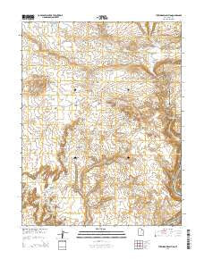
~ The Windows Section UT topo map, 1:24000 scale, 7.5 X 7.5 Minute, Current, 2014
The Windows Section, Utah, USGS topographic map dated 2014.
Includes geographic coordinates (latitude and longitude). This topographic map is suitable for hiking, camping, and exploring, or framing it as a wall map.
Printed on-demand using high resolution imagery, on heavy weight and acid free paper, or alternatively on a variety of synthetic materials.
Topos available on paper, Waterproof, Poly, or Tyvek. Usually shipping rolled, unless combined with other folded maps in one order.
- Product Number: USGS-7789448
- Free digital map download (high-resolution, GeoPDF): The Windows Section, Utah (file size: 33 MB)
- Map Size: please refer to the dimensions of the GeoPDF map above
- Weight (paper map): ca. 55 grams
- Map Type: POD USGS Topographic Map
- Map Series: US Topo
- Map Verison: Current
- Cell ID: 44816
- Datum: North American Datum of 1983
- Map Projection: Transverse Mercator
- Map Cell Name: The Windows Section
- Grid size: 7.5 X 7.5 Minute
- Date on map: 2014
- Map Scale: 1:24000
- Geographical region: Utah, United States
Neighboring Maps:
All neighboring USGS topo maps are available for sale online at a variety of scales.
Spatial coverage:
Topo map The Windows Section, Utah, covers the geographical area associated the following places:
- Cove Arch - Little Bridge - Salt Spring - Surprise Arch - Willow Flats - Petrified Sand Dunes - Freshwater Spring - Elephant Arch - South Windows - Schmidt Arch - Jackass Canyon - Beckwith Arch - Arches National Park - Bench Arch - Pothole Arch - Jacks Mummy - Three Gossips - Ham Rock - Double Arch - Sausage Rock - Adam and Eve - Parade of Elephants - Turnbow Cabin - Panorama Point - Queen Nefertiti Rock - Twisted Doughnut Arch - Salt Wash Rapids - Garden of Eden - Flatiron Arch - Ring Arch - The Great Wall - Ribbon Arch - Duck-on-the-Rock - Buccaneer Rock - The Organ - Football Arch - Fiery Furnace Viewpoint - Hole-in-the-Fin Arch - Owl Rock - Elephant Butte - Salt Valley - Cloister Arch - The Windows Section - Salt Valley Overlook - Hole-in-the-Wall - La Sal Mountains Viewpoint - Salt Spring - Cliff Arch - Sheep Rock - Turret Arch - The Phallus - Tower of Babel - The Poodle - Cache Valley Wash - Balanced Rock - The Lovers - Courthouse Towers - Rock Pinnacles - Devils Golf Ball - Queue Jughandle Arch - North Window - Cache Valley - Cove of Caves - Winter Camp Wash - Nose Bridge - Salt Valley Wash - Park Avenue - Courthouse Wash Bridge - North Park Avenue Trailhead - Twin Arch - Webbing Arch - Queen Victoria Rock - Herdina Park - Delicate Arch Viewpoint - Eye of the Whale Arch
- Map Area ID: AREA38.7538.625-109.625-109.5
- Northwest corner Lat/Long code: USGSNW38.75-109.625
- Northeast corner Lat/Long code: USGSNE38.75-109.5
- Southwest corner Lat/Long code: USGSSW38.625-109.625
- Southeast corner Lat/Long code: USGSSE38.625-109.5
- Northern map edge Latitude: 38.75
- Southern map edge Latitude: 38.625
- Western map edge Longitude: -109.625
- Eastern map edge Longitude: -109.5


