
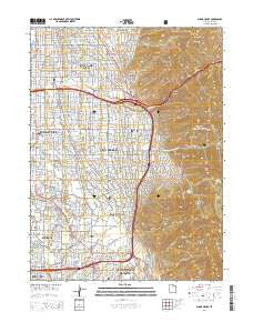
~ Sugar House UT topo map, 1:24000 scale, 7.5 X 7.5 Minute, Current, 2014
Sugar House, Utah, USGS topographic map dated 2014.
Includes geographic coordinates (latitude and longitude). This topographic map is suitable for hiking, camping, and exploring, or framing it as a wall map.
Printed on-demand using high resolution imagery, on heavy weight and acid free paper, or alternatively on a variety of synthetic materials.
Topos available on paper, Waterproof, Poly, or Tyvek. Usually shipping rolled, unless combined with other folded maps in one order.
- Product Number: USGS-7789312
- Free digital map download (high-resolution, GeoPDF): Sugar House, Utah (file size: 37 MB)
- Map Size: please refer to the dimensions of the GeoPDF map above
- Weight (paper map): ca. 55 grams
- Map Type: POD USGS Topographic Map
- Map Series: US Topo
- Map Verison: Current
- Cell ID: 43619
- Datum: North American Datum of 1983
- Map Projection: Transverse Mercator
- Map Cell Name: Sugar House
- Grid size: 7.5 X 7.5 Minute
- Date on map: 2014
- Map Scale: 1:24000
- Geographical region: Utah, United States
Neighboring Maps:
All neighboring USGS topo maps are available for sale online at a variety of scales.
Spatial coverage:
Topo map Sugar House, Utah, covers the geographical area associated the following places:
- Mount Olympus - Juniper - Canyon Cove - Foothill - Southwood Three and Four - Southwood - Holladay Grove - Arcadia Park Condominium - Spring Creek - Bee and Gee - Fontaine Bleu - Blue Spruce - Briarwood Estates - Brimhall - Yuma View - Twin Peaks Circle - Pine Hill - Edinburgh of Holladay Condominium - Southview - Esquire Acres Five - Hillside Village - Maywood Hills - Cambridge Estates - Startup - Cambria Pines - Millrace - Hillsden Addition - Windsor Place - Callister - Crus - Oakcliff Park - Ute - Biscayne Park - Sears Addition - Andlor - Highland Orchard Condominium - Convest - Kimberly Park - Mount Vernon Cove Condominium - Tyler - Countryside Condominium - Ridge Road - Florence Hollow - Sleepy Hollow Two - Three Fountains Townhomes and Manor Houses - Murray Condominium - Flamingo Hills - Spring Lane Condominium - Boulevard - Jeremy - Mount Olympus Park - Stev Linda - Phylden - Rustic Acres - Wilson - Casto Pines Condominium - Canyon Rim - East Meadows - Holladay - Prowswood Plaza Condominium - Wayland Station at Old Farm Condo - Shady Grove - Holman - Holladay Edgehill - Brubaker Park - Lakewood - Johnson - Holladay Acres - Mandalay Terrace - Nathan Circle - Arbor Estates - Woodstock - Bay - Briarwood Hills - Fors - Calann - Holladay Manor - Fardown Estates - Centennial Estates - Shadow Mountain - Ellison Woods - Akron - Carriage Lane Condominium - Dover Hill Condominium - The Woodlands Business Park - Lornadale - Green Meadows - Wren Hollow - Holladay Meadows Condominium - Paul - Shalamar - Sugar House - Shaleh Estates - Brookside Park - Monte Carlo Condominium - Manuela - Cottonwood Grove Condominium - Creekside East Condominium - Winfield - Pine Mountain
- Map Area ID: AREA40.7540.625-111.875-111.75
- Northwest corner Lat/Long code: USGSNW40.75-111.875
- Northeast corner Lat/Long code: USGSNE40.75-111.75
- Southwest corner Lat/Long code: USGSSW40.625-111.875
- Southeast corner Lat/Long code: USGSSE40.625-111.75
- Northern map edge Latitude: 40.75
- Southern map edge Latitude: 40.625
- Western map edge Longitude: -111.875
- Eastern map edge Longitude: -111.75


