
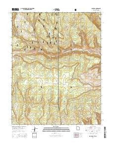
~ Ray Mesa UT topo map, 1:24000 scale, 7.5 X 7.5 Minute, Current, 2014
Ray Mesa, Utah, USGS topographic map dated 2014.
Includes geographic coordinates (latitude and longitude). This topographic map is suitable for hiking, camping, and exploring, or framing it as a wall map.
Printed on-demand using high resolution imagery, on heavy weight and acid free paper, or alternatively on a variety of synthetic materials.
Topos available on paper, Waterproof, Poly, or Tyvek. Usually shipping rolled, unless combined with other folded maps in one order.
- Product Number: USGS-7788818
- Free digital map download (high-resolution, GeoPDF): Ray Mesa, Utah (file size: 41 MB)
- Map Size: please refer to the dimensions of the GeoPDF map above
- Weight (paper map): ca. 55 grams
- Map Type: POD USGS Topographic Map
- Map Series: US Topo
- Map Verison: Current
- Cell ID: 37191
- Datum: North American Datum of 1983
- Map Projection: Transverse Mercator
- Map Cell Name: Ray Mesa
- Grid size: 7.5 X 7.5 Minute
- Date on map: 2014
- Map Scale: 1:24000
- Geographical region: Utah, United States
Neighboring Maps:
All neighboring USGS topo maps are available for sale online at a variety of scales.
Spatial coverage:
Topo map Ray Mesa, Utah, covers the geographical area associated the following places:
- Ice Lake Creek - Blue Cap Mine - Elray Mine - Evening Star Mine - Morning Star Mine - Hop Creek - Too High Mine - Summer Mine - Birthday Mine - Lion Canyon - Pole Spring Canyon - Eva Mine - Lion Gulch - Midnight Mine - Black Hat Mine - Vista Grande Mine - Firefly Mine - Lion Creek Mine - Maud Mine - Lucky Number One Mine - Dry Draw - Marjorie Ann Mine - Hideout Mesa - Vanadium Queen Mine - Lode Mine - Yip Yip Mine - New Yellow Spot Mine - The Horn - Yellow Bird Mines - Brushy Basin Number 3 Mine - Saint Patrick Claims - Independence Mine - State Line Draw - Wedge Mine - Saint Patrick Number Seven Mine - Brushy Basin Number 3 Mine - Soldier Boy Mine - Pine Lodge Ranch - Trough Draw - Greasy Spoon Mine - Yucca Mine - Lion Canyon - Lion Creek - Confusion Mine - Soldier Boy Mine - Twomile Creek - Gray Daun Mine - Ray Mesa - Hang Dog Creek - Rattlesnake Mine - Blue Cap Mine - Hespeotus Mine - Spring Canyon - Brushy Basin Mine - Uranium Girl Mine - Wray Mesa Mine - Prayer Number Nine Mine - Angle Mine - Sumner Mine - Carla May Group Mine - Trinity Canyon
- Map Area ID: AREA38.37538.25-109.125-109
- Northwest corner Lat/Long code: USGSNW38.375-109.125
- Northeast corner Lat/Long code: USGSNE38.375-109
- Southwest corner Lat/Long code: USGSSW38.25-109.125
- Southeast corner Lat/Long code: USGSSE38.25-109
- Northern map edge Latitude: 38.375
- Southern map edge Latitude: 38.25
- Western map edge Longitude: -109.125
- Eastern map edge Longitude: -109


