
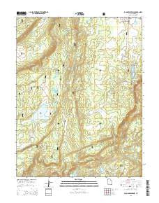
~ Jacobs Reservoir UT topo map, 1:24000 scale, 7.5 X 7.5 Minute, Current, 2014
Jacobs Reservoir, Utah, USGS topographic map dated 2014.
Includes geographic coordinates (latitude and longitude). This topographic map is suitable for hiking, camping, and exploring, or framing it as a wall map.
Printed on-demand using high resolution imagery, on heavy weight and acid free paper, or alternatively on a variety of synthetic materials.
Topos available on paper, Waterproof, Poly, or Tyvek. Usually shipping rolled, unless combined with other folded maps in one order.
- Product Number: USGS-7787011
- Free digital map download (high-resolution, GeoPDF): Jacobs Reservoir, Utah (file size: 35 MB)
- Map Size: please refer to the dimensions of the GeoPDF map above
- Weight (paper map): ca. 55 grams
- Map Type: POD USGS Topographic Map
- Map Series: US Topo
- Map Verison: Current
- Cell ID: 70488
- Datum: North American Datum of 1983
- Map Projection: Transverse Mercator
- Map Cell Name: Jacobs Reservoir
- Grid size: 7.5 X 7.5 Minute
- Date on map: 2014
- Map Scale: 1:24000
- Geographical region: Utah, United States
Neighboring Maps:
All neighboring USGS topo maps are available for sale online at a variety of scales.
Spatial coverage:
Topo map Jacobs Reservoir, Utah, covers the geographical area associated the following places:
- Blue Lake - Riddle Flat - Rim Lake - Jacobs Valley Dam - Spectacle Lake - Five Lakes - Four Lakes - Boulder Mountain - Purple Lake - Black Lake - Basin Flats - Sawmill Lake - Spectacle Lake Dam - Barney Lake - Jacobs Valley - Squaw Spring - Bear Lake - Dark Valley Shelf - Jacobs Reservoir - McGath Lake - Stairs Slope - Boulder Swale - South Point - Burr Top - Broken Draw - Dark Valley Lake - Bakeskillet Lake - Cuddyback Lake - West Boulder Draw - Rock Spring Ridge - Dry Lake - Row Lakes
- Map Area ID: AREA38.12538-111.625-111.5
- Northwest corner Lat/Long code: USGSNW38.125-111.625
- Northeast corner Lat/Long code: USGSNE38.125-111.5
- Southwest corner Lat/Long code: USGSSW38-111.625
- Southeast corner Lat/Long code: USGSSE38-111.5
- Northern map edge Latitude: 38.125
- Southern map edge Latitude: 38
- Western map edge Longitude: -111.625
- Eastern map edge Longitude: -111.5


