
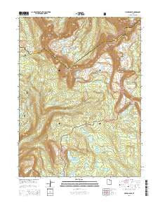
~ Hayden Peak UT topo map, 1:24000 scale, 7.5 X 7.5 Minute, Current, 2014
Hayden Peak, Utah, USGS topographic map dated 2014.
Includes geographic coordinates (latitude and longitude). This topographic map is suitable for hiking, camping, and exploring, or framing it as a wall map.
Printed on-demand using high resolution imagery, on heavy weight and acid free paper, or alternatively on a variety of synthetic materials.
Topos available on paper, Waterproof, Poly, or Tyvek. Usually shipping rolled, unless combined with other folded maps in one order.
- Product Number: USGS-7786821
- Free digital map download (high-resolution, GeoPDF): Hayden Peak, Utah (file size: 34 MB)
- Map Size: please refer to the dimensions of the GeoPDF map above
- Weight (paper map): ca. 55 grams
- Map Type: POD USGS Topographic Map
- Map Series: US Topo
- Map Verison: Current
- Cell ID: 70336
- Datum: North American Datum of 1983
- Map Projection: Transverse Mercator
- Map Cell Name: Hayden Peak
- Grid size: 7.5 X 7.5 Minute
- Date on map: 2014
- Map Scale: 1:24000
- Geographical region: Utah, United States
Neighboring Maps:
All neighboring USGS topo maps are available for sale online at a variety of scales.
Spatial coverage:
Topo map Hayden Peak, Utah, covers the geographical area associated the following places:
- Amy Lake - Pigeon Milk Spring - Ostler Peak - Morat Lakes - Four Lakes Basin - Margie Lake - McPheters Lake - Jean Lake - Powell Lake - Tadpole Lake - Governor Dern Lake - Spread Eagle Peak - Bud Lake - Blythe Lake - Pine Island Lake - Range Lake - Uintah Lake - Skinner Cutoff Trail - Rocky Sea Pass - Faxon Lake - East Fork Duchesne River - Hayden Pass - Evermann Lake - Middle Basin - Ryder Lake - Butterfly Campground - Scudder Lake - Highline Trail Head Campground - Mount Agassiz - Daynes Lake - East Fork Pinto Lake Trail - Olga Lake - Brooks Lake - Naturalist Basin - Marshall Lake - Wyman Lake - Verrill Lake - Bedground Lake - Rosalie Lake - Lost Lake - Packard Lake - Hyatt Lake - Gatman Lake - Margo Lake - Hoover Lake - Shaler Lake - Lily Pad Lake - Kermsuh Lake - Shale Lake - Farney Lake - Wilder Lake - Marsell Canyon - Gladys Lake - Allen Lake - Jordan Lake - Jeff Lake - Blue Lake - Dale Lake - Lightning Lake - Walcott Lake - Highline Trail - Rainbow Lake - Hayden Peak - Pinto Lake - LeConte Lake - Carolyn Lake - Dean Lake - Fish Hatchery Lake - Butterfly Lake - Palisade Lake - Maba Lake
- Map Area ID: AREA40.7540.625-110.875-110.75
- Northwest corner Lat/Long code: USGSNW40.75-110.875
- Northeast corner Lat/Long code: USGSNE40.75-110.75
- Southwest corner Lat/Long code: USGSSW40.625-110.875
- Southeast corner Lat/Long code: USGSSE40.625-110.75
- Northern map edge Latitude: 40.75
- Southern map edge Latitude: 40.625
- Western map edge Longitude: -110.875
- Eastern map edge Longitude: -110.75


