
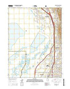
~ Farmington UT topo map, 1:24000 scale, 7.5 X 7.5 Minute, Current, 2014
Farmington, Utah, USGS topographic map dated 2014.
Includes geographic coordinates (latitude and longitude). This topographic map is suitable for hiking, camping, and exploring, or framing it as a wall map.
Printed on-demand using high resolution imagery, on heavy weight and acid free paper, or alternatively on a variety of synthetic materials.
Topos available on paper, Waterproof, Poly, or Tyvek. Usually shipping rolled, unless combined with other folded maps in one order.
- Product Number: USGS-7786121
- Free digital map download (high-resolution, GeoPDF): Farmington, Utah (file size: 28 MB)
- Map Size: please refer to the dimensions of the GeoPDF map above
- Weight (paper map): ca. 55 grams
- Map Type: POD USGS Topographic Map
- Map Series: US Topo
- Map Verison: Current
- Cell ID: 15027
- Datum: North American Datum of 1983
- Map Projection: Transverse Mercator
- Map Cell Name: Farmington
- Grid size: 7.5 X 7.5 Minute
- Date on map: 2014
- Map Scale: 1:24000
- Geographical region: Utah, United States
Neighboring Maps:
All neighboring USGS topo maps are available for sale online at a variety of scales.
Spatial coverage:
Topo map Farmington, Utah, covers the geographical area associated the following places:
- Hillside Meadow - Elliot Estates - Newmann - Rosedale - Happy Acres - Park View - Parrish Park - Peach Tree Condominium - Meadow Brook Estates Condominium - The Pines - Phipps Condominium - Grass Valley Acres - Willow Farm Estates - Surrey Downs - Golden West - Meadow Springs - Brentwood Circle - Bountiful Park - Old Farm Estates - Bonito Verde - Evergreen - Lakeview Hills - Center Village - Ruflin Circle - Oak Lane - J Hill Johnson - Quail Run - Rolling Hills Meadows - Main Street Island View - Campbell - Homestead Condominium - Smoot Farm Estates - Plat A - Telford - Judge Holbrook - Evergreen Acres - Farmington - McKean Estates - Farmington Bay - Holbrook - Van Dyke and Willey Condominium - Green Meadows - Continental Townhouse Condominium - Country Hills of Farmington - Streeper Park - Farmington Heights - Continental Estates - Meadowbrook Acres - Thirteenth South - Carriage Crossing Condominium - Sunny-View Estates - Birdella Park - Chase Lane West - Valencia - Fackrell - Glendale - Hillwest - Woodland Springs - Thomas - Meadowbrook - Chateau Park - Kum-Li Meadows - Bountiful - Sunset Hills - Bountiful Gardens Apartment Homes - Kirkhaven - Gold - Stone Creek - Tanglewood Acres - Smoot Farm Estates - Country Station Condominium - Marlinda West - North Ridge - Pitford Acres - Cedar Springs Condominium - Raynor Acres - Dar Verda - Duncan Estates - Arcadia - Pheasantbrook - Stoney Brook - LaVista Park - Williams West - Lynnhaven - Chase Lane Estates - Bayview Park - Susie Ranch - Sunset View Estates - Cherry Park - Chase Lane Village - Placid Cove - Benchmark Village - Mountainside - Croper - Hogan Park - Sport Sales Plaza - Ruflin Acres - Applewood Estates - Bridle Acres - Willowbrook Farm - Casa Loma
- Map Area ID: AREA4140.875-112-111.875
- Northwest corner Lat/Long code: USGSNW41-112
- Northeast corner Lat/Long code: USGSNE41-111.875
- Southwest corner Lat/Long code: USGSSW40.875-112
- Southeast corner Lat/Long code: USGSSE40.875-111.875
- Northern map edge Latitude: 41
- Southern map edge Latitude: 40.875
- Western map edge Longitude: -112
- Eastern map edge Longitude: -111.875


