
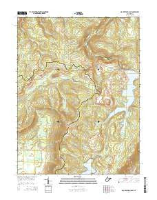
~ Mount Storm Lake WV topo map, 1:24000 scale, 7.5 X 7.5 Minute, Historical, 2014
Mount Storm Lake, West Virginia, USGS topographic map dated 2014.
Includes geographic coordinates (latitude and longitude). This topographic map is suitable for hiking, camping, and exploring, or framing it as a wall map.
Printed on-demand using high resolution imagery, on heavy weight and acid free paper, or alternatively on a variety of synthetic materials.
Topos available on paper, Waterproof, Poly, or Tyvek. Usually shipping rolled, unless combined with other folded maps in one order.
- Product Number: USGS-7784522
- Free digital map download (high-resolution, GeoPDF): Mount Storm Lake, West Virginia (file size: 37 MB)
- Map Size: please refer to the dimensions of the GeoPDF map above
- Weight (paper map): ca. 55 grams
- Map Type: POD USGS Topographic Map
- Map Series: US Topo
- Map Verison: Historical
- Cell ID: 30828
- Datum: North American Datum of 1983
- Map Projection: Transverse Mercator
- Map Cell Name: Mount Storm Lake
- Grid size: 7.5 X 7.5 Minute
- Date on map: 2014
- Map Scale: 1:24000
- Geographical region: West Virginia, United States
Neighboring Maps:
All neighboring USGS topo maps are available for sale online at a variety of scales.
Spatial coverage:
Topo map Mount Storm Lake, West Virginia, covers the geographical area associated the following places:
- Brown Mountain - Mount Storm Power Station Fire Department and Rescue - Timberman Ridge - Mud Run - Morgan Run - Dobbin Ridge - Elder Swamp - Accident School (historical) - Helmick Run - Snowy Point - Fourmile Run - Red Sea Run - Stony River Dam - Mount Storm Lake - Stony River Reservoir - Red Brush Ridge - Cherry Ridge - Ice House Rocks - Camp 94 (historical) - Union District - Camp Seventytwo - Stony River Dam - Mount Storm Power Station - Laurel Run
- Map Area ID: AREA39.2539.125-79.375-79.25
- Northwest corner Lat/Long code: USGSNW39.25-79.375
- Northeast corner Lat/Long code: USGSNE39.25-79.25
- Southwest corner Lat/Long code: USGSSW39.125-79.375
- Southeast corner Lat/Long code: USGSSE39.125-79.25
- Northern map edge Latitude: 39.25
- Southern map edge Latitude: 39.125
- Western map edge Longitude: -79.375
- Eastern map edge Longitude: -79.25


