
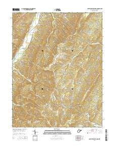
~ Lost River State Park WV topo map, 1:24000 scale, 7.5 X 7.5 Minute, Historical, 2014
Lost River State Park, West Virginia, USGS topographic map dated 2014.
Includes geographic coordinates (latitude and longitude). This topographic map is suitable for hiking, camping, and exploring, or framing it as a wall map.
Printed on-demand using high resolution imagery, on heavy weight and acid free paper, or alternatively on a variety of synthetic materials.
Topos available on paper, Waterproof, Poly, or Tyvek. Usually shipping rolled, unless combined with other folded maps in one order.
- Product Number: USGS-7754850
- Free digital map download (high-resolution, GeoPDF): Lost River State Park, West Virginia (file size: 45 MB)
- Map Size: please refer to the dimensions of the GeoPDF map above
- Weight (paper map): ca. 55 grams
- Map Type: POD USGS Topographic Map
- Map Series: US Topo
- Map Verison: Historical
- Cell ID: 26674
- Datum: North American Datum of 1983
- Map Projection: Transverse Mercator
- Map Cell Name: Lost River State Park
- Grid size: 7.5 X 7.5 Minute
- Date on map: 2014
- Map Scale: 1:24000
- Geographical region: West Virginia, United States
Neighboring Maps:
All neighboring USGS topo maps are available for sale online at a variety of scales.
Spatial coverage:
Topo map Lost River State Park, West Virginia, covers the geographical area associated the following places:
- Cabin Run - Lost River State Park - Miller Rock - Strawderman School (historical) - Wilkins School (historical) - Buckhorn Church - Helmick Rock - South Fork Structure One Dam - East Ridge - Topsy School (historical) - Harness Ford Bridge - Little Mountain - Hunting Ridge - Cranny Crow Overlook - Cheeks Rocks - Lee Sulphur Spring - Big Ridge Lookout Tower
- Map Area ID: AREA3938.875-79-78.875
- Northwest corner Lat/Long code: USGSNW39-79
- Northeast corner Lat/Long code: USGSNE39-78.875
- Southwest corner Lat/Long code: USGSSW38.875-79
- Southeast corner Lat/Long code: USGSSE38.875-78.875
- Northern map edge Latitude: 39
- Southern map edge Latitude: 38.875
- Western map edge Longitude: -79
- Eastern map edge Longitude: -78.875


