
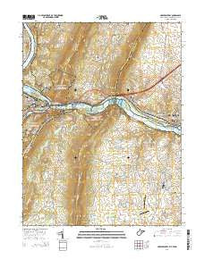
~ Harpers Ferry WV topo map, 1:24000 scale, 7.5 X 7.5 Minute, Historical, 2014
Harpers Ferry, West Virginia, USGS topographic map dated 2014.
Includes geographic coordinates (latitude and longitude). This topographic map is suitable for hiking, camping, and exploring, or framing it as a wall map.
Printed on-demand using high resolution imagery, on heavy weight and acid free paper, or alternatively on a variety of synthetic materials.
Topos available on paper, Waterproof, Poly, or Tyvek. Usually shipping rolled, unless combined with other folded maps in one order.
- Product Number: USGS-7754646
- Free digital map download (high-resolution, GeoPDF): Harpers Ferry, West Virginia (file size: 38 MB)
- Map Size: please refer to the dimensions of the GeoPDF map above
- Weight (paper map): ca. 55 grams
- Map Type: POD USGS Topographic Map
- Map Series: US Topo
- Map Verison: Historical
- Cell ID: 19389
- Datum: North American Datum of 1983
- Map Projection: Transverse Mercator
- Map Cell Name: Harpers Ferry
- Grid size: 7.5 X 7.5 Minute
- Date on map: 2014
- Map Scale: 1:24000
- Geographical region: West Virginia, United States
Neighboring Maps:
All neighboring USGS topo maps are available for sale online at a variety of scales.
Spatial coverage:
Topo map Harpers Ferry, West Virginia, covers the geographical area associated the following places:
- Augusta - Elvan - Keister - Samples Manor - Georges Mill - Lovettsville - Britain - Weverton - Virginius (historical) - Bolington - Stonebraker (historical) - Garretts Mill - Neersville - Roelkeys Knoll - Knoxville - Loudoun Heights - New Addition - Sandy Hook - Rice - Harpers Ferry - Brunswick - Pomona - Pleasantville - Yarrowsburg - Lower Town - Water Acres - Springdale - Pine Hill Estates
- Map Area ID: AREA39.37539.25-77.75-77.625
- Northwest corner Lat/Long code: USGSNW39.375-77.75
- Northeast corner Lat/Long code: USGSNE39.375-77.625
- Southwest corner Lat/Long code: USGSSW39.25-77.75
- Southeast corner Lat/Long code: USGSSE39.25-77.625
- Northern map edge Latitude: 39.375
- Southern map edge Latitude: 39.25
- Western map edge Longitude: -77.75
- Eastern map edge Longitude: -77.625


