
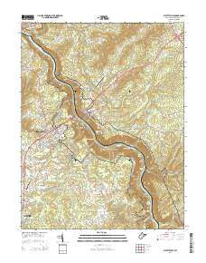
~ Fayetteville WV topo map, 1:24000 scale, 7.5 X 7.5 Minute, Historical, 2014
Fayetteville, West Virginia, USGS topographic map dated 2014.
Includes geographic coordinates (latitude and longitude). This topographic map is suitable for hiking, camping, and exploring, or framing it as a wall map.
Printed on-demand using high resolution imagery, on heavy weight and acid free paper, or alternatively on a variety of synthetic materials.
Topos available on paper, Waterproof, Poly, or Tyvek. Usually shipping rolled, unless combined with other folded maps in one order.
- Product Number: USGS-7754532
- Free digital map download (high-resolution, GeoPDF): Fayetteville, West Virginia (file size: 45 MB)
- Map Size: please refer to the dimensions of the GeoPDF map above
- Weight (paper map): ca. 55 grams
- Map Type: POD USGS Topographic Map
- Map Series: US Topo
- Map Verison: Historical
- Cell ID: 15101
- Datum: North American Datum of 1983
- Map Projection: Transverse Mercator
- Map Cell Name: Fayetteville
- Grid size: 7.5 X 7.5 Minute
- Date on map: 2014
- Map Scale: 1:24000
- Geographical region: West Virginia, United States
Neighboring Maps:
All neighboring USGS topo maps are available for sale online at a variety of scales.
Spatial coverage:
Topo map Fayetteville, West Virginia, covers the geographical area associated the following places:
- Carver (historical) - South Caperton - Garten - MacDougal - Ames Heights - Gatewood - Michigan (historical) - Fayette Heights - South Fayette - Fayetteville - Gaymont - Ames - Newlyn (historical) - Caperton - Beauty - Mincar (historical) - Nuttalburg (historical) - Lansing - Boone (historical) - Pine Grove - Whitney (historical) - Harlem Heights - Edmond - Elverton - South Nuttall (historical) - Hawks Nest - Bachman - Fayette - Keeneys Creek - Grayden - Sunnyside (historical) - Oak Ridge - Kaymoor - Hico
- Map Area ID: AREA38.12538-81.125-81
- Northwest corner Lat/Long code: USGSNW38.125-81.125
- Northeast corner Lat/Long code: USGSNE38.125-81
- Southwest corner Lat/Long code: USGSSW38-81.125
- Southeast corner Lat/Long code: USGSSE38-81
- Northern map edge Latitude: 38.125
- Southern map edge Latitude: 38
- Western map edge Longitude: -81.125
- Eastern map edge Longitude: -81


