
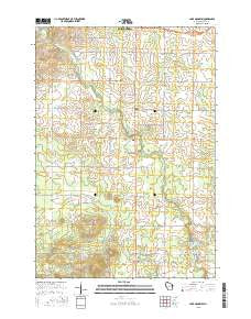
~ Lake Manakiki WI topo map, 1:24000 scale, 7.5 X 7.5 Minute, 2015
Lake Manakiki, Wisconsin, USGS topographic map dated 2015.
Includes geographic coordinates (latitude and longitude). This topographic map is suitable for hiking, camping, and exploring, or framing it as a wall map.
Printed on-demand using high resolution imagery, on heavy weight and acid free paper, or alternatively on a variety of synthetic materials.
Topos available on paper, Waterproof, Poly, or Tyvek. Usually shipping rolled, unless combined with other folded maps in one order.
- Product Number: USGS-7685082
- Free digital map download (high-resolution, GeoPDF): Lake Manakiki, Wisconsin (file size: 22 MB)
- Map Size: please refer to the dimensions of the GeoPDF map above
- Weight (paper map): ca. 55 grams
- Map Type: POD USGS Topographic Map
- Map Series: US Topo
- Map Verison: Current
- Cell ID: 24523
- Datum: North American Datum of 1983
- Map Projection: Transverse Mercator
- Map Cell Name: Lake Manakiki
- Grid size: 7.5 X 7.5 Minute
- Date on map: 2015
- Map Scale: 1:24000
- Geographical region: Wisconsin, United States
Neighboring Maps:
All neighboring USGS topo maps are available for sale online at a variety of scales.
Spatial coverage:
Topo map Lake Manakiki, Wisconsin, covers the geographical area associated the following places:
- Manakiki Lake 135 - Puff Creek - Trinity Lutheran School - Ebbe Park - Richfield Rural Fire Department - Lake Manakiki - Smith Quarry - Richfield Church (historical) - Town of Cameron - Lake Kaunewinne - Town of Richfield - Far View School (historical) - Brook Lawn Memory Garden Cemetery - South Branch Yellow River - Richfield Cemetery - Dairy Belt School (historical) - Golden Glow School (historical) - Trinity Cemetery - East Rock School (historical) - Beaver Creek - Westview Country Club - Trinity Church - Cameron Pride School (historical) - Lower North Wood County Park 2WP371 Dam - Oak Leaf School (historical) - North Wood County Park - Long School (historical)
- Map Area ID: AREA44.62544.5-90.25-90.125
- Northwest corner Lat/Long code: USGSNW44.625-90.25
- Northeast corner Lat/Long code: USGSNE44.625-90.125
- Southwest corner Lat/Long code: USGSSW44.5-90.25
- Southeast corner Lat/Long code: USGSSE44.5-90.125
- Northern map edge Latitude: 44.625
- Southern map edge Latitude: 44.5
- Western map edge Longitude: -90.25
- Eastern map edge Longitude: -90.125


