
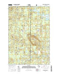
~ Thunder Mountain WI topo map, 1:24000 scale, 7.5 X 7.5 Minute, 2015
Thunder Mountain, Wisconsin, USGS topographic map dated 2015.
Includes geographic coordinates (latitude and longitude). This topographic map is suitable for hiking, camping, and exploring, or framing it as a wall map.
Printed on-demand using high resolution imagery, on heavy weight and acid free paper, or alternatively on a variety of synthetic materials.
Topos available on paper, Waterproof, Poly, or Tyvek. Usually shipping rolled, unless combined with other folded maps in one order.
- Product Number: USGS-7675720
- Free digital map download (high-resolution, GeoPDF): Thunder Mountain, Wisconsin (file size: 25 MB)
- Map Size: please refer to the dimensions of the GeoPDF map above
- Weight (paper map): ca. 55 grams
- Map Type: POD USGS Topographic Map
- Map Series: US Topo
- Map Verison: Current
- Cell ID: 45050
- Datum: North American Datum of 1983
- Map Projection: Transverse Mercator
- Map Cell Name: Thunder Mountain
- Grid size: 7.5 X 7.5 Minute
- Date on map: 2015
- Map Scale: 1:24000
- Geographical region: Wisconsin, United States
Neighboring Maps:
All neighboring USGS topo maps are available for sale online at a variety of scales.
Spatial coverage:
Topo map Thunder Mountain, Wisconsin, covers the geographical area associated the following places:
- Boundary Lake - The Spring - Dell Lake - Flower Lake - Cedar Lake - Balsam Lake - Caldron Falls Reservoir - Twin Bessies - Thunder Mountain Ranch - North Fork Thunder River - Forbes Creek - Camp Bird State Youth Recreational Center - Mirror Lake - Frieda Lake - Mountain Lake - Lackawanna Lake - Bottle Lake - Hay Creek - Ledge Lake - Borth Lake - Fryingpan Lake - Huber Lake - Kiss Lake - Handsaw Creek - South Fork Thunder River - Thunder River State Rearing Station - Thunder Mountain - Hazel Lake - Sand Lake - Wonder Lake - Rollins Lake
- Map Area ID: AREA45.37545.25-88.375-88.25
- Northwest corner Lat/Long code: USGSNW45.375-88.375
- Northeast corner Lat/Long code: USGSNE45.375-88.25
- Southwest corner Lat/Long code: USGSSW45.25-88.375
- Southeast corner Lat/Long code: USGSSE45.25-88.25
- Northern map edge Latitude: 45.375
- Southern map edge Latitude: 45.25
- Western map edge Longitude: -88.375
- Eastern map edge Longitude: -88.25


