
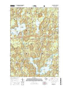
~ Moose Lake WI topo map, 1:24000 scale, 7.5 X 7.5 Minute, 2015
Moose Lake, Wisconsin, USGS topographic map dated 2015.
Includes geographic coordinates (latitude and longitude). This topographic map is suitable for hiking, camping, and exploring, or framing it as a wall map.
Printed on-demand using high resolution imagery, on heavy weight and acid free paper, or alternatively on a variety of synthetic materials.
Topos available on paper, Waterproof, Poly, or Tyvek. Usually shipping rolled, unless combined with other folded maps in one order.
- Product Number: USGS-7675550
- Free digital map download (high-resolution, GeoPDF): Moose Lake, Wisconsin (file size: 27 MB)
- Map Size: please refer to the dimensions of the GeoPDF map above
- Weight (paper map): ca. 55 grams
- Map Type: POD USGS Topographic Map
- Map Series: US Topo
- Map Verison: Current
- Cell ID: 30150
- Datum: North American Datum of 1983
- Map Projection: Transverse Mercator
- Map Cell Name: Moose Lake
- Grid size: 7.5 X 7.5 Minute
- Date on map: 2015
- Map Scale: 1:24000
- Geographical region: Wisconsin, United States
Neighboring Maps:
All neighboring USGS topo maps are available for sale online at a variety of scales.
Spatial coverage:
Topo map Moose Lake, Wisconsin, covers the geographical area associated the following places:
- Chip Lake - Lynch Creek - Balsam Creek Flowage - Sawyer Civilian Conservation Corps Camp (historical) - Paradise Island - Catfish Lake - Moose Lake - Teal River Flowage - Ghost Creek - Moose Lake 1911 C640 Dam - Turtle Lake - Teal Lake - Ghost Lake WP307 Dam - Wolf Island - Loon Island - Ghost Lake - Snipe Lake - Bullhead Lake - Ghost Lake 22 - Moose Lake 190 - Spruce Lake - Pine Island - Balsam Creek Waterfowl Area - West Fork School (historical) - Raspberry Island - West Fork Lookout Tower - Perch Lake - West Fork Dam - Goodman Lake - Teal River - Lynch Lake - Town of Round Lake Fire Department - Station 1 - Bulldog Springs - Bird Island - Two Deer Lake - Boos Lake - Folson Island - Moose Lake Campground - Moose River - McNott Island - Town of Spider Lake - Chippewa River Campground
- Map Area ID: AREA46.12546-91.125-91
- Northwest corner Lat/Long code: USGSNW46.125-91.125
- Northeast corner Lat/Long code: USGSNE46.125-91
- Southwest corner Lat/Long code: USGSSW46-91.125
- Southeast corner Lat/Long code: USGSSE46-91
- Northern map edge Latitude: 46.125
- Southern map edge Latitude: 46
- Western map edge Longitude: -91.125
- Eastern map edge Longitude: -91


