
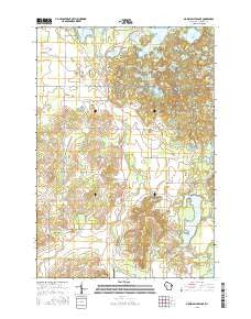
~ Marsh Miller Lake WI topo map, 1:24000 scale, 7.5 X 7.5 Minute, 2015
Marsh Miller Lake, Wisconsin, USGS topographic map dated 2015.
Includes geographic coordinates (latitude and longitude). This topographic map is suitable for hiking, camping, and exploring, or framing it as a wall map.
Printed on-demand using high resolution imagery, on heavy weight and acid free paper, or alternatively on a variety of synthetic materials.
Topos available on paper, Waterproof, Poly, or Tyvek. Usually shipping rolled, unless combined with other folded maps in one order.
- Product Number: USGS-7675411
- Free digital map download (high-resolution, GeoPDF): Marsh Miller Lake, Wisconsin (file size: 23 MB)
- Map Size: please refer to the dimensions of the GeoPDF map above
- Weight (paper map): ca. 55 grams
- Map Type: POD USGS Topographic Map
- Map Series: US Topo
- Map Verison: Current
- Cell ID: 27822
- Datum: North American Datum of 1983
- Map Projection: Transverse Mercator
- Map Cell Name: Marsh-Miller Lake
- Grid size: 7.5 X 7.5 Minute
- Date on map: 2015
- Map Scale: 1:24000
- Geographical region: Wisconsin, United States
Neighboring Maps:
All neighboring USGS topo maps are available for sale online at a variety of scales.
Spatial coverage:
Topo map Marsh Miller Lake, Wisconsin, covers the geographical area associated the following places:
- Chick Lake - Taylor Lake - Fernwood School (historical) - Mud Lake - Salisbury Lake - Gunderson Farms - Tillinghast School (historical) - South Shattuck Lake - Sampson Townhall - Hansons 2WP792 Dam - Weeks Lakes - Camp Norwesco - Knickerbocker Lake - Marsh-Miller Lake 16 - Rufledt Cemetery - Camp Chippewa Bay - North of North Shattuck Lake - Trout Creek School (historical) - North Shattuck Lake - Fur Farm Lake - Pine Grove School (historical) - Town of Bloomer - Loon Lake - Two Island Lake - Horseshoe Lake - Logger Lake - Camp Manitou - Snake Lake - Larrabee Lake - Bloomer Townhall - Marsh-Miller Lake - Dark Lake - Calkins North Lake - Ace-In-The-Hole Lake - Elmhurst School (historical) - Camp Pokonokah Hills - Hodge Lake - Rock Lake - Jeanstow Lake - Herde Lake - Payne Lake - Ice Age National Scientific Reserve - Skaw Farm - Pikes Peak - Town of Sampson - Pine Corner School (historical) - Tillinghast Cemetery - Church of God - Lakeland Airport (historical)
- Map Area ID: AREA45.2545.125-91.5-91.375
- Northwest corner Lat/Long code: USGSNW45.25-91.5
- Northeast corner Lat/Long code: USGSNE45.25-91.375
- Southwest corner Lat/Long code: USGSSW45.125-91.5
- Southeast corner Lat/Long code: USGSSE45.125-91.375
- Northern map edge Latitude: 45.25
- Southern map edge Latitude: 45.125
- Western map edge Longitude: -91.5
- Eastern map edge Longitude: -91.375


