
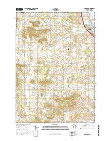
~ Como Creek WI topo map, 1:24000 scale, 7.5 X 7.5 Minute, 2015
Como Creek, Wisconsin, USGS topographic map dated 2015.
Includes geographic coordinates (latitude and longitude). This topographic map is suitable for hiking, camping, and exploring, or framing it as a wall map.
Printed on-demand using high resolution imagery, on heavy weight and acid free paper, or alternatively on a variety of synthetic materials.
Topos available on paper, Waterproof, Poly, or Tyvek. Usually shipping rolled, unless combined with other folded maps in one order.
- Product Number: USGS-7675371
- Free digital map download (high-resolution, GeoPDF): Como Creek, Wisconsin (file size: 21 MB)
- Map Size: please refer to the dimensions of the GeoPDF map above
- Weight (paper map): ca. 55 grams
- Map Type: POD USGS Topographic Map
- Map Series: US Topo
- Map Verison: Current
- Cell ID: 9778
- Datum: North American Datum of 1983
- Map Projection: Transverse Mercator
- Map Cell Name: Como Creek
- Grid size: 7.5 X 7.5 Minute
- Date on map: 2015
- Map Scale: 1:24000
- Geographical region: Wisconsin, United States
Neighboring Maps:
All neighboring USGS topo maps are available for sale online at a variety of scales.
Spatial coverage:
Topo map Como Creek, Wisconsin, covers the geographical area associated the following places:
- Cooks Valley Dairy Farm - Cooks Valley Church (historical) - Saint Johns School (historical) - Kelm Farm - Cooks Valley Townhall - Hay Creek Nursery - Chippewa Fire District Station 6 - Zion Church (historical) - Needy Acres - Cooks Valley Cemetery - Sunny Side School (historical) - Good Shepherd Lutheran Church - D D Farms - Rooney Farm - Town of Cooks Valley - Auburn School (historical) - Lake Como - Loew School (historical) - Auburn Cemetery - Auburn Dale School (historical) - Saint Johns Church - Trout Brook Farm - Prill Dairy Farm - Bloomer Medical Center - Como Creek - Auburn Center School (historical)
- Map Area ID: AREA45.12545-91.625-91.5
- Northwest corner Lat/Long code: USGSNW45.125-91.625
- Northeast corner Lat/Long code: USGSNE45.125-91.5
- Southwest corner Lat/Long code: USGSSW45-91.625
- Southeast corner Lat/Long code: USGSSE45-91.5
- Northern map edge Latitude: 45.125
- Southern map edge Latitude: 45
- Western map edge Longitude: -91.625
- Eastern map edge Longitude: -91.5


