
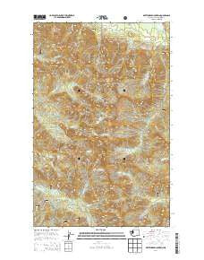
~ Whitehorse Mountain WA topo map, 1:24000 scale, 7.5 X 7.5 Minute, Current, 2014
Whitehorse Mountain, Washington, USGS topographic map dated 2014.
Includes geographic coordinates (latitude and longitude). This topographic map is suitable for hiking, camping, and exploring, or framing it as a wall map.
Printed on-demand using high resolution imagery, on heavy weight and acid free paper, or alternatively on a variety of synthetic materials.
Topos available on paper, Waterproof, Poly, or Tyvek. Usually shipping rolled, unless combined with other folded maps in one order.
- Product Number: USGS-7533789
- Free digital map download (high-resolution, GeoPDF): Whitehorse Mountain, Washington (file size: 33 MB)
- Map Size: please refer to the dimensions of the GeoPDF map above
- Weight (paper map): ca. 55 grams
- Map Type: POD USGS Topographic Map
- Map Series: US Topo
- Map Verison: Current
- Cell ID: 48815
- Datum: North American Datum of 1983
- Map Projection: Transverse Mercator
- Map Cell Name: Whitehorse Mountain
- Grid size: 7.5 X 7.5 Minute
- Date on map: 2014
- Map Scale: 1:24000
- Geographical region: Washington, United States
Neighboring Maps:
All neighboring USGS topo maps are available for sale online at a variety of scales.
Spatial coverage:
Topo map Whitehorse Mountain, Washington, covers the geographical area associated the following places:
- So-Bahli-Alhi Glacier - Bullen Lake - Sevenmile Creek - Squire Creek Pass - Liberty Mountain - Whitehorse Ridge - Buckeye Creek - Tin Can Gap - Boulder River Wilderness - Windy Pass - Big Bear Mountain - Goat Flat - Whitehorse Mountain - Mount Bullen Lakes - Lone Tree Pass - Gerkman Creek - Noble Lake - Wellman Basin - Tucker Lake - French Peak - Baldy Creek - Sill Basin - Mount Bullen - Queest-alb Glacier (not official) - Windy Creek - Three Fingers
- Map Area ID: AREA48.2548.125-121.75-121.625
- Northwest corner Lat/Long code: USGSNW48.25-121.75
- Northeast corner Lat/Long code: USGSNE48.25-121.625
- Southwest corner Lat/Long code: USGSSW48.125-121.75
- Southeast corner Lat/Long code: USGSSE48.125-121.625
- Northern map edge Latitude: 48.25
- Southern map edge Latitude: 48.125
- Western map edge Longitude: -121.75
- Eastern map edge Longitude: -121.625


