
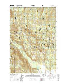
~ Trout Lake WA topo map, 1:24000 scale, 7.5 X 7.5 Minute, Current, 2014
Trout Lake, Washington, USGS topographic map dated 2014.
Includes geographic coordinates (latitude and longitude). This topographic map is suitable for hiking, camping, and exploring, or framing it as a wall map.
Printed on-demand using high resolution imagery, on heavy weight and acid free paper, or alternatively on a variety of synthetic materials.
Topos available on paper, Waterproof, Poly, or Tyvek. Usually shipping rolled, unless combined with other folded maps in one order.
- Product Number: USGS-7533533
- Free digital map download (high-resolution, GeoPDF): Trout Lake, Washington (file size: 35 MB)
- Map Size: please refer to the dimensions of the GeoPDF map above
- Weight (paper map): ca. 55 grams
- Map Type: POD USGS Topographic Map
- Map Series: US Topo
- Map Verison: Current
- Cell ID: 45749
- Datum: North American Datum of 1983
- Map Projection: Transverse Mercator
- Map Cell Name: Trout Lake
- Grid size: 7.5 X 7.5 Minute
- Date on map: 2014
- Map Scale: 1:24000
- Geographical region: Washington, United States
Neighboring Maps:
All neighboring USGS topo maps are available for sale online at a variety of scales.
Spatial coverage:
Topo map Trout Lake, Washington, covers the geographical area associated the following places:
- Hole in the Ground Creek - Bear Spring - Green Canyon - Buck Creek - Hollenbeck Landing Strip (historical) - Gotchen Creek - McDonald Ridge - Morrison Creek - Crofton Creek - Lower Butte - Cakey Butte - Wicky Creek - Klickitat County Fire District 1 - Ninefoot Creek - Cascade Creek - Trout Lake Big Tree - Trout Lake - Trout Lake Airport - Wicky Creek Shelter - Flattop Mountain - Eckhart Point - East Flattop Lookout - Morrison Creek Horse Camp - Trout Lake Creek Campground - Mount Adams Forest Camp - Green Canyon Creek - Haystack Butte - West Flattop Lookout
- Map Area ID: AREA46.12546-121.625-121.5
- Northwest corner Lat/Long code: USGSNW46.125-121.625
- Northeast corner Lat/Long code: USGSNE46.125-121.5
- Southwest corner Lat/Long code: USGSSW46-121.625
- Southeast corner Lat/Long code: USGSSE46-121.5
- Northern map edge Latitude: 46.125
- Southern map edge Latitude: 46
- Western map edge Longitude: -121.625
- Eastern map edge Longitude: -121.5


