
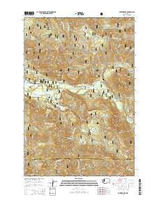
~ Tower Rock WA topo map, 1:24000 scale, 7.5 X 7.5 Minute, Current, 2014
Tower Rock, Washington, USGS topographic map dated 2014.
Includes geographic coordinates (latitude and longitude). This topographic map is suitable for hiking, camping, and exploring, or framing it as a wall map.
Printed on-demand using high resolution imagery, on heavy weight and acid free paper, or alternatively on a variety of synthetic materials.
Topos available on paper, Waterproof, Poly, or Tyvek. Usually shipping rolled, unless combined with other folded maps in one order.
- Product Number: USGS-7533527
- Free digital map download (high-resolution, GeoPDF): Tower Rock, Washington (file size: 36 MB)
- Map Size: please refer to the dimensions of the GeoPDF map above
- Weight (paper map): ca. 55 grams
- Map Type: POD USGS Topographic Map
- Map Series: US Topo
- Map Verison: Current
- Cell ID: 45489
- Datum: North American Datum of 1983
- Map Projection: Transverse Mercator
- Map Cell Name: Tower Rock
- Grid size: 7.5 X 7.5 Minute
- Date on map: 2014
- Map Scale: 1:24000
- Geographical region: Washington, United States
Neighboring Maps:
All neighboring USGS topo maps are available for sale online at a variety of scales.
Spatial coverage:
Topo map Tower Rock, Washington, covers the geographical area associated the following places:
- North Fork Campground - North Fork Group Camp - Tower Rock - Yellowjacket Creek - North Fork Cispus River - Lone Tree Lake - Swede Creek - Tower Rock Campground - Covell Creek - Kidd Creek - Slickrock Creek - North Fork Guard Station - Polk Creek - Black Rock Pond - Lambert Creek - Irish Creek - Lewis County Fire District 14 Randle Fire and Emergency Medical Services Station 2 - Lone Tree Mountain - Tongue Mountain - Yellowjacket Pond Day Use Site - Tyler Creek - Burley Mountain - Camp Creek - Horse Creek - Cispus Job Corps Conservation Center - Tower Rock Beaver Ponds - Dry Creek - Galena Creek - High Bridge Creek - McCoy Creek - Smoothrock Creek - Bishop Mountain
- Map Area ID: AREA46.546.375-121.875-121.75
- Northwest corner Lat/Long code: USGSNW46.5-121.875
- Northeast corner Lat/Long code: USGSNE46.5-121.75
- Southwest corner Lat/Long code: USGSSW46.375-121.875
- Southeast corner Lat/Long code: USGSSE46.375-121.75
- Northern map edge Latitude: 46.5
- Southern map edge Latitude: 46.375
- Western map edge Longitude: -121.875
- Eastern map edge Longitude: -121.75


