
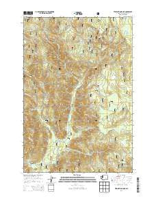
~ Termination Point WA topo map, 1:24000 scale, 7.5 X 7.5 Minute, Current, 2014
Termination Point, Washington, USGS topographic map dated 2014.
Includes geographic coordinates (latitude and longitude). This topographic map is suitable for hiking, camping, and exploring, or framing it as a wall map.
Printed on-demand using high resolution imagery, on heavy weight and acid free paper, or alternatively on a variety of synthetic materials.
Topos available on paper, Waterproof, Poly, or Tyvek. Usually shipping rolled, unless combined with other folded maps in one order.
- Product Number: USGS-7533473
- Free digital map download (high-resolution, GeoPDF): Termination Point, Washington (file size: 34 MB)
- Map Size: please refer to the dimensions of the GeoPDF map above
- Weight (paper map): ca. 55 grams
- Map Type: POD USGS Topographic Map
- Map Series: US Topo
- Map Verison: Current
- Cell ID: 44596
- Datum: North American Datum of 1983
- Map Projection: Transverse Mercator
- Map Cell Name: Termination Point
- Grid size: 7.5 X 7.5 Minute
- Date on map: 2014
- Map Scale: 1:24000
- Geographical region: Washington, United States
Neighboring Maps:
All neighboring USGS topo maps are available for sale online at a variety of scales.
Spatial coverage:
Topo map Termination Point, Washington, covers the geographical area associated the following places:
- Wind River Mine - Paradise Hills - Dry Creek - Ninemile Creek - South Butte - McClellan Meadows - Upper Wind River Winter Sports Area - Proverbial Creek - Falls Creek - Big Hollow Creek - Oldman Creek - Howe Ridge - Middle Butte - Government Mineral Springs - Termination Point - Bubbling Mike Spring - North Butte - Juice Creek - Tyee Springs - Trapper Creek - Paradise Creek Campground - Home Guard Station - Oldman Pass - Lava Butte - Pete Gulch - Rock Point - Bourbon Creek - Government Spring Guard Station - Paradise Trail - Ridge Trail - Falls Creek Trail - Lava Butte Trail - Falls Creek Falls - Paradise Creek - Black Creek
- Map Area ID: AREA4645.875-122-121.875
- Northwest corner Lat/Long code: USGSNW46-122
- Northeast corner Lat/Long code: USGSNE46-121.875
- Southwest corner Lat/Long code: USGSSW45.875-122
- Southeast corner Lat/Long code: USGSSE45.875-121.875
- Northern map edge Latitude: 46
- Southern map edge Latitude: 45.875
- Western map edge Longitude: -122
- Eastern map edge Longitude: -121.875


