
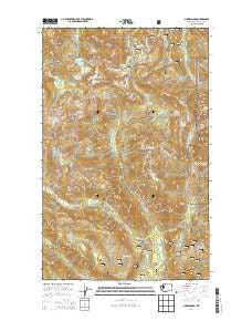
~ Shuksan Arm WA topo map, 1:24000 scale, 7.5 X 7.5 Minute, Current, 2014
Shuksan Arm, Washington, USGS topographic map dated 2014.
Includes geographic coordinates (latitude and longitude). This topographic map is suitable for hiking, camping, and exploring, or framing it as a wall map.
Printed on-demand using high resolution imagery, on heavy weight and acid free paper, or alternatively on a variety of synthetic materials.
Topos available on paper, Waterproof, Poly, or Tyvek. Usually shipping rolled, unless combined with other folded maps in one order.
- Product Number: USGS-7532845
- Free digital map download (high-resolution, GeoPDF): Shuksan Arm, Washington (file size: 33 MB)
- Map Size: please refer to the dimensions of the GeoPDF map above
- Weight (paper map): ca. 55 grams
- Map Type: POD USGS Topographic Map
- Map Series: US Topo
- Map Verison: Current
- Cell ID: 41218
- Datum: North American Datum of 1983
- Map Projection: Transverse Mercator
- Map Cell Name: Shuksan Arm
- Grid size: 7.5 X 7.5 Minute
- Date on map: 2014
- Map Scale: 1:24000
- Geographical region: Washington, United States
Neighboring Maps:
All neighboring USGS topo maps are available for sale online at a variety of scales.
Spatial coverage:
Topo map Shuksan Arm, Washington, covers the geographical area associated the following places:
- Avalanche Gorge - Mount Baker Ski Resort - Highwood Lake - Coleman Pinnacle - Austin Pass Lake - Mount Baker Lodge - Maiden Lake - Heather Meadows - Iceberg Lake - Galena Camp - Rainbow Falls - Terminal Lake - Mount Baker Lodge Lakes - Barometer Mountain - Marten Lake - Mount Hermann - Shuksan Creek - Mazama Lake - Bagley Lakes - Lake Ann - Kulshan Ridge - Galena Chain Lakes - Baker Hot Spring - Lava Divide - Hayes Lake - Rainbow Creek - Huntoon Point - Fisher Chimney - Sunrise Lake - Table Mountain - Panorama Dome - Austin Pass - Shuksan Arm - Rainbow Lake - Vista Viewpoint - Table Mountain Glacier - Picture Lake - Ptarmigan Ridge - Mazama Falls - Mount Baker Post Office (historical) - Mount Baker Wilderness - Arbuthnet Lake - Mazama Dome - Camp Kiser
- Map Area ID: AREA48.87548.75-121.75-121.625
- Northwest corner Lat/Long code: USGSNW48.875-121.75
- Northeast corner Lat/Long code: USGSNE48.875-121.625
- Southwest corner Lat/Long code: USGSSW48.75-121.75
- Southeast corner Lat/Long code: USGSSE48.75-121.625
- Northern map edge Latitude: 48.875
- Southern map edge Latitude: 48.75
- Western map edge Longitude: -121.75
- Eastern map edge Longitude: -121.625


