
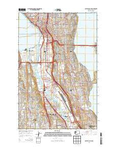
~ Seattle South WA topo map, 1:24000 scale, 7.5 X 7.5 Minute, Current, 2014
Seattle South, Washington, USGS topographic map dated 2014.
Includes geographic coordinates (latitude and longitude). This topographic map is suitable for hiking, camping, and exploring, or framing it as a wall map.
Printed on-demand using high resolution imagery, on heavy weight and acid free paper, or alternatively on a variety of synthetic materials.
Topos available on paper, Waterproof, Poly, or Tyvek. Usually shipping rolled, unless combined with other folded maps in one order.
- Product Number: USGS-7532815
- Free digital map download (high-resolution, GeoPDF): Seattle South, Washington (file size: 30 MB)
- Map Size: please refer to the dimensions of the GeoPDF map above
- Weight (paper map): ca. 55 grams
- Map Type: POD USGS Topographic Map
- Map Series: US Topo
- Map Verison: Current
- Cell ID: 40401
- Datum: North American Datum of 1983
- Map Projection: Transverse Mercator
- Map Cell Name: Seattle South
- Grid size: 7.5 X 7.5 Minute
- Date on map: 2014
- Map Scale: 1:24000
- Geographical region: Washington, United States
Neighboring Maps:
All neighboring USGS topo maps are available for sale online at a variety of scales.
Spatial coverage:
Topo map Seattle South, Washington, covers the geographical area associated the following places:
- Georgetown - Rainier Beach - Delridge - Glendale - Mount Baker - Lakewood - Rainier Valley - Tamill - Columbia - Beacon Hill - Belltown - Madrona - Youngstown - South Seattle - Brighton - Denny Regrade - White Center - Duwamish - Seattle - Dunlap - Highland Park - Holly Park - Yesler Terrace - Westward Mobile Park - Suburban Villa Mobile Home Park - Columbia City - Capitol Hill - Roxbury Heights - Hillman City (historical) - Mann - South Park - Van Asselt - Seward Park
- Map Area ID: AREA47.62547.5-122.375-122.25
- Northwest corner Lat/Long code: USGSNW47.625-122.375
- Northeast corner Lat/Long code: USGSNE47.625-122.25
- Southwest corner Lat/Long code: USGSSW47.5-122.375
- Southeast corner Lat/Long code: USGSSE47.5-122.25
- Northern map edge Latitude: 47.625
- Southern map edge Latitude: 47.5
- Western map edge Longitude: -122.375
- Eastern map edge Longitude: -122.25


