
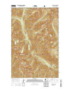
~ Saska Peak WA topo map, 1:24000 scale, 7.5 X 7.5 Minute, Current, 2014
Saska Peak, Washington, USGS topographic map dated 2014.
Includes geographic coordinates (latitude and longitude). This topographic map is suitable for hiking, camping, and exploring, or framing it as a wall map.
Printed on-demand using high resolution imagery, on heavy weight and acid free paper, or alternatively on a variety of synthetic materials.
Topos available on paper, Waterproof, Poly, or Tyvek. Usually shipping rolled, unless combined with other folded maps in one order.
- Product Number: USGS-7532787
- Free digital map download (high-resolution, GeoPDF): Saska Peak, Washington (file size: 35 MB)
- Map Size: please refer to the dimensions of the GeoPDF map above
- Weight (paper map): ca. 55 grams
- Map Type: POD USGS Topographic Map
- Map Series: US Topo
- Map Verison: Current
- Cell ID: 40009
- Datum: North American Datum of 1983
- Map Projection: Transverse Mercator
- Map Cell Name: Saska Peak
- Grid size: 7.5 X 7.5 Minute
- Date on map: 2014
- Map Scale: 1:24000
- Geographical region: Washington, United States
Neighboring Maps:
All neighboring USGS topo maps are available for sale online at a variety of scales.
Spatial coverage:
Topo map Saska Peak, Washington, covers the geographical area associated the following places:
- Saska Pass - Pomas Creek - Cow Creek Meadows - Cottonwood Campground - Choral Creek - Ice Creek Shelter - Larch Lakes - Gopher Mountain - Garland Peak - Emerald Peak - Borealis Ridge - Cottonwood Guard Station - Duncan Hill - Larch Lakes Creek - Garland Creek - Devils Smoke Stack - Rampart Mountain - Borealis Peak - Milham Pass - Aurora Creek - Ice Creek - Shetipo Creek - Ice Creek Camp - Choral Lake - Cow Creek - Myrtle Lake - Duncan Hill Trail - Fifth of July Mountain - Snow Brushy Creek - Fern Lake - Pinnacle Creek - Saska Peak - Cool Creek - Larch Lake Campground - Borealis Pass - Anthem Creek
- Map Area ID: AREA48.12548-120.75-120.625
- Northwest corner Lat/Long code: USGSNW48.125-120.75
- Northeast corner Lat/Long code: USGSNE48.125-120.625
- Southwest corner Lat/Long code: USGSSW48-120.75
- Southeast corner Lat/Long code: USGSSE48-120.625
- Northern map edge Latitude: 48.125
- Southern map edge Latitude: 48
- Western map edge Longitude: -120.75
- Eastern map edge Longitude: -120.625


