
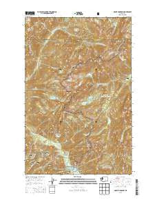
~ Mount Skokomish WA topo map, 1:24000 scale, 7.5 X 7.5 Minute, Current, 2014
Mount Skokomish, Washington, USGS topographic map dated 2014.
Includes geographic coordinates (latitude and longitude). This topographic map is suitable for hiking, camping, and exploring, or framing it as a wall map.
Printed on-demand using high resolution imagery, on heavy weight and acid free paper, or alternatively on a variety of synthetic materials.
Topos available on paper, Waterproof, Poly, or Tyvek. Usually shipping rolled, unless combined with other folded maps in one order.
- Product Number: USGS-7531811
- Free digital map download (high-resolution, GeoPDF): Mount Skokomish, Washington (file size: 33 MB)
- Map Size: please refer to the dimensions of the GeoPDF map above
- Weight (paper map): ca. 55 grams
- Map Type: POD USGS Topographic Map
- Map Series: US Topo
- Map Verison: Current
- Cell ID: 30811
- Datum: North American Datum of 1983
- Map Projection: Transverse Mercator
- Map Cell Name: Mount Skokomish
- Grid size: 7.5 X 7.5 Minute
- Date on map: 2014
- Map Scale: 1:24000
- Geographical region: Washington, United States
Neighboring Maps:
All neighboring USGS topo maps are available for sale online at a variety of scales.
Spatial coverage:
Topo map Mount Skokomish, Washington, covers the geographical area associated the following places:
- Mount Gladys - Four Stream - Staircase Rapids - Copper Creek - Smith Lake - Mount Lincoln - Staircase - Mildred Lakes - Copper Mountain - Staircase Ranger Station - Murdock Lakes - Staircase Campground - Bear Gulch - Staircase Campground - Black and White Lakes - Eight Stream - Mount Ellinor - Lake of the Angels - Lake Ben - Lincoln Creek - Mount Skokomish - Mount Rose - Elk Creek - Sawtooth Ridge - Nine Stream Camp - Mount Cruiser - Camp Pleasant - Flapjack Lakes - Mount Pershing - Bear Gulch Camp (historical) - Staircase Ranger Station - Slate Creek - Mount Skokomish Wilderness - Hammer Creek - Wagonwheel Lake - Nine Stream - Darky Mine (historical) - Hammer Cabin (historical) - Mount Henderson - Mount Stone - Hagen Lake
- Map Area ID: AREA47.62547.5-123.375-123.25
- Northwest corner Lat/Long code: USGSNW47.625-123.375
- Northeast corner Lat/Long code: USGSNE47.625-123.25
- Southwest corner Lat/Long code: USGSSW47.5-123.375
- Southeast corner Lat/Long code: USGSSE47.5-123.25
- Northern map edge Latitude: 47.625
- Southern map edge Latitude: 47.5
- Western map edge Longitude: -123.375
- Eastern map edge Longitude: -123.25


