
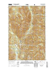
~ Davis Peak WA topo map, 1:24000 scale, 7.5 X 7.5 Minute, Current, 2014
Davis Peak, Washington, USGS topographic map dated 2014.
Includes geographic coordinates (latitude and longitude). This topographic map is suitable for hiking, camping, and exploring, or framing it as a wall map.
Printed on-demand using high resolution imagery, on heavy weight and acid free paper, or alternatively on a variety of synthetic materials.
Topos available on paper, Waterproof, Poly, or Tyvek. Usually shipping rolled, unless combined with other folded maps in one order.
- Product Number: USGS-7529455
- Free digital map download (high-resolution, GeoPDF): Davis Peak, Washington (file size: 36 MB)
- Map Size: please refer to the dimensions of the GeoPDF map above
- Weight (paper map): ca. 55 grams
- Map Type: POD USGS Topographic Map
- Map Series: US Topo
- Map Verison: Current
- Cell ID: 11446
- Datum: North American Datum of 1983
- Map Projection: Transverse Mercator
- Map Cell Name: Davis Peak
- Grid size: 7.5 X 7.5 Minute
- Date on map: 2014
- Map Scale: 1:24000
- Geographical region: Washington, United States
Neighboring Maps:
All neighboring USGS topo maps are available for sale online at a variety of scales.
Spatial coverage:
Topo map Davis Peak, Washington, covers the geographical area associated the following places:
- Lake Terence - Davis Peak - Silver Creek - Little Salmon la Sac - Lake Michael Trail - Salmon la Sac - Little Boulder Creek - Salmon La Sac - Huckleberry Mountain - Cooper River - Paris Creek - Fortune Creek - Goat Mountain - Jolly Mountain Lookout - Michael Lake - Little Salmon la Sac Creek - Cayuse Campground - Jolly Mountain - Moonshine Lake - Hawkins Mountain - Big Boulder Creek - Waptus River - Jolly Mountain Lookout Trail - Salmon la Sac Creek - Hour Creek - Hour Creek Campground - Salmon la Sac Forest Service Station - Middle Fork Paris Creek - South Fork Paris Creek - Red Mountain Trail - Little Salmon la Sac - Davis Peak Lookout - Salmon la Sac - Opal Lake - Davis Peak Lookout Trail - Camp Creek - North Fork Paris Creek - Salmon la Sac Campground - Elsnor Mine - China Point - South Fork Fortune Creek
- Map Area ID: AREA47.547.375-121.125-121
- Northwest corner Lat/Long code: USGSNW47.5-121.125
- Northeast corner Lat/Long code: USGSNE47.5-121
- Southwest corner Lat/Long code: USGSSW47.375-121.125
- Southeast corner Lat/Long code: USGSSE47.375-121
- Northern map edge Latitude: 47.5
- Southern map edge Latitude: 47.375
- Western map edge Longitude: -121.125
- Eastern map edge Longitude: -121


