
~ Agnes Mtn WA topo map, 1:24000 scale, 7.5 X 7.5 Minute, Historical, 1963, updated 1987
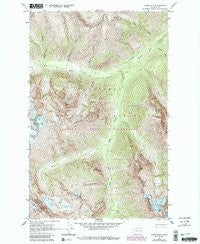
Agnes Mtn , Washington, USGS topographic map dated 1963.
Includes geographic coordinates (latitude and longitude). This topographic map is suitable for hiking, camping, and exploring, or framing it as a wall map.
Printed on-demand using high resolution imagery, on heavy weight and acid free paper, or alternatively on a variety of synthetic materials.
Topos available on paper, Waterproof, Poly, or Tyvek. Usually shipping rolled, unless combined with other folded maps in one order.
- Product Number: USGS-6009409
- Free digital map download (high-resolution, GeoPDF): Agnes Mtn , Washington (file size: 20 MB)
- Map Size: please refer to the dimensions of the GeoPDF map above
- Weight (paper map): ca. 55 grams
- Map Type: POD USGS Topographic Map
- Map Series: HTMC
- Map Verison: Historical
- Cell ID: 268
- Scan ID: 239757
- Imprint Year: 1987
- Woodland Tint: Yes
- Visual Version Number: 1
- Photo Revision Year: 1987
- Aerial Photo Year: 1984
- Edit Year: 1987
- Field Check Year: 1963
- Datum: NAD27
- Map Projection: Polyconic
- Map published by United States Geological Survey
- Map Language: English
- Scanner Resolution: 600 dpi
- Map Cell Name: Agnes Mountain
- Grid size: 7.5 X 7.5 Minute
- Date on map: 1963
- Map Scale: 1:24000
- Geographical region: Washington, United States
Neighboring Maps:
All neighboring USGS topo maps are available for sale online at a variety of scales.
Spatial coverage:
Topo map Agnes Mtn , Washington, covers the geographical area associated the following places:
- Saddle Bow Mountain - Sisters Creek - Cedar Camp - Glacier Creek - Mount Blankenship - Weasel Creek - Hemlock Camp - Trapper Creek - South Fork Agnes Creek - Blue Glacier - Helebore Creek - Dark Peak - Fivemile Camp - Swamp Creek - Dark Glacier - Icy Creek - Rimrock Creek - Bannock Mountain - Agnes Mountain - Needle Peak - Bannock Lakes - Pass Creek - Spruce Creek - West Fork Agnes Creek - Gunsight Peak - Swamp Creek Camp - Yellow Creek
- Map Area ID: AREA48.37548.25-121-120.875
- Northwest corner Lat/Long code: USGSNW48.375-121
- Northeast corner Lat/Long code: USGSNE48.375-120.875
- Southwest corner Lat/Long code: USGSSW48.25-121
- Southeast corner Lat/Long code: USGSSE48.25-120.875
- Northern map edge Latitude: 48.375
- Southern map edge Latitude: 48.25
- Western map edge Longitude: -121
- Eastern map edge Longitude: -120.875


