
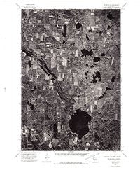
~ Frederic SE WI topo map, 1:24000 scale, 7.5 X 7.5 Minute, Historical, 1974, updated 1976
Frederic SE, Wisconsin, USGS topographic map dated 1974.
Includes geographic coordinates (latitude and longitude). This topographic map is suitable for hiking, camping, and exploring, or framing it as a wall map.
Printed on-demand using high resolution imagery, on heavy weight and acid free paper, or alternatively on a variety of synthetic materials.
Topos available on paper, Waterproof, Poly, or Tyvek. Usually shipping rolled, unless combined with other folded maps in one order.
- Product Number: USGS-6005733
- Free digital map download (high-resolution, GeoPDF): Frederic SE, Wisconsin (file size: 12 MB)
- Map Size: please refer to the dimensions of the GeoPDF map above
- Weight (paper map): ca. 55 grams
- Map Type: POD USGS Topographic Map
- Map Series: HTMC
- Map Verison: Historical
- Cell ID: 3814
- Scan ID: 800361
- Imprint Year: 1976
- Aerial Photo Year: 1974
- Datum: NAD27
- Map Projection: Lambert Conformal Conic
- Orthophoto: Quad
- Map published by United States Geological Survey
- Keywords: Nonstandard Press Run
- Map Language: English
- Scanner Resolution: 508 dpi
- Map Cell Name: Big Round Lake
- Grid size: 7.5 X 7.5 Minute
- Date on map: 1974
- Map Scale: 1:24000
- Geographical region: Wisconsin, United States
Neighboring Maps:
All neighboring USGS topo maps are available for sale online at a variety of scales.
Spatial coverage:
Topo map Frederic SE, Wisconsin, covers the geographical area associated the following places:
- Lost Lake - Dahl Lake - Mullins Lake - Loon Lake - Lake 18-1 1 - Pine Lake - McKenzie Lake - Straight River - Little Pine Lake - Sedge Lake - Rhinstad Lake - LaFollette School - Depot Lake - Devils Marsh - Johnstown Cemetery - Big Round Lake - Holst School - Lamont Lake - Bass Lake - Johnson Lake - Long Lake - Vincent Lake - Footes Lake - Cragwood Corporation Number 2 H810 Dam - Sucker Creek - Mackie Lake - Town of Georgetown - Lake Evelyn - Zion Church - Saint Croix Reservation - Saint Paul Church - Round Lake Chapel - Hay Lake - Little Ward Lake - Town of Bone Lake - Ward Lake - Pickerel Lake - Andrus Lake - Big Lake
- Map Area ID: AREA45.62545.5-92.375-92.25
- Northwest corner Lat/Long code: USGSNW45.625-92.375
- Northeast corner Lat/Long code: USGSNE45.625-92.25
- Southwest corner Lat/Long code: USGSSW45.5-92.375
- Southeast corner Lat/Long code: USGSSE45.5-92.25
- Northern map edge Latitude: 45.625
- Southern map edge Latitude: 45.5
- Western map edge Longitude: -92.375
- Eastern map edge Longitude: -92.25


