
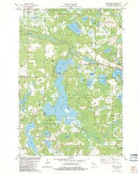
~ Siren East WI topo map, 1:24000 scale, 7.5 X 7.5 Minute, Historical, 1982, updated 1983
Siren East, Wisconsin, USGS topographic map dated 1982.
Includes geographic coordinates (latitude and longitude). This topographic map is suitable for hiking, camping, and exploring, or framing it as a wall map.
Printed on-demand using high resolution imagery, on heavy weight and acid free paper, or alternatively on a variety of synthetic materials.
Topos available on paper, Waterproof, Poly, or Tyvek. Usually shipping rolled, unless combined with other folded maps in one order.
- Product Number: USGS-6000436
- Free digital map download (high-resolution, GeoPDF): Siren East, Wisconsin (file size: 10 MB)
- Map Size: please refer to the dimensions of the GeoPDF map above
- Weight (paper map): ca. 55 grams
- Map Type: POD USGS Topographic Map
- Map Series: HTMC
- Map Verison: Historical
- Cell ID: 41506
- Scan ID: 501896
- Imprint Year: 1983
- Woodland Tint: Yes
- Aerial Photo Year: 1978
- Edit Year: 1982
- Field Check Year: 1979
- Datum: NAD27
- Map Projection: Lambert Conformal Conic
- Map published by United States Geological Survey
- Map Language: English
- Scanner Resolution: 508 dpi
- Map Cell Name: Siren East
- Grid size: 7.5 X 7.5 Minute
- Date on map: 1982
- Map Scale: 1:24000
- Geographical region: Wisconsin, United States
Neighboring Maps:
All neighboring USGS topo maps are available for sale online at a variety of scales.
Spatial coverage:
Topo map Siren East, Wisconsin, covers the geographical area associated the following places:
- Tucker Lake - Sunfish Lake - Clam Lake 2WP1065 Dam - Viola Lake Alliance Church - Kent Creek - Viola Lake Cemetery - Town of Siren - Horseshoe Lake - Sand Lake - Viola Lake - Burnett County Airport - Mallard Slough - Lyman Bridge Public Access - Money Lake - North Fork Clam River - Lower Clam Lake - Silver Lake - Clam Lake - Put Lake - Larson Lake - Meenon Townhall - Long Lake - Dongola School - Town of Meenon - Sleighbell Slough - Taylor Lake - Clam Lake Cemetery - Tamarack Lake - Burnett County Jail - Sand Lake Townhall - Burnett County Sheriff's Office - LaFollette Townhall - Pike Lake - Owl Lake - Clam Lake - Bass Lake - Burnett County - Crooked Lake - Kruger School - Webster Elementary School - Cranberry Lake
- Map Area ID: AREA45.87545.75-92.375-92.25
- Northwest corner Lat/Long code: USGSNW45.875-92.375
- Northeast corner Lat/Long code: USGSNE45.875-92.25
- Southwest corner Lat/Long code: USGSSW45.75-92.375
- Southeast corner Lat/Long code: USGSSE45.75-92.25
- Northern map edge Latitude: 45.875
- Southern map edge Latitude: 45.75
- Western map edge Longitude: -92.375
- Eastern map edge Longitude: -92.25


