
~ Rice Lake WI topo map, 1:250000 scale, 1 X 2 Degree, Historical, 1953, updated 1967
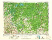
Rice Lake, Wisconsin, USGS topographic map dated 1953.
Includes geographic coordinates (latitude and longitude). This topographic map is suitable for hiking, camping, and exploring, or framing it as a wall map.
Printed on-demand using high resolution imagery, on heavy weight and acid free paper, or alternatively on a variety of synthetic materials.
Topos available on paper, Waterproof, Poly, or Tyvek. Usually shipping rolled, unless combined with other folded maps in one order.
- Product Number: USGS-6000184
- Free digital map download (high-resolution, GeoPDF): Rice Lake, Wisconsin (file size: 11 MB)
- Map Size: please refer to the dimensions of the GeoPDF map above
- Weight (paper map): ca. 55 grams
- Map Type: POD USGS Topographic Map
- Map Series: HTMC
- Map Verison: Historical
- Cell ID: 68986
- Scan ID: 803010
- Imprint Year: 1967
- Woodland Tint: Yes
- Photo Revision Year: 1966
- Edit Year: 1966
- Field Check Year: 1953
- Datum: Unstated
- Map Projection: Transverse Mercator
- Map published by United States Geological Survey
- Map Language: English
- Scanner Resolution: 508 dpi
- Map Cell Name: Rice Lake
- Grid size: 1 X 2 Degree
- Date on map: 1953
- Map Scale: 1:250000
- Geographical region: Wisconsin, United States
Neighboring Maps:
All neighboring USGS topo maps are available for sale online at a variety of scales.
Spatial coverage:
Topo map Rice Lake, Wisconsin, covers the geographical area associated the following places:
- Clark - Ridgeland - Prentice - Colburn - Eagleton - Little Round Lake - Fifield - Ingram - Clifford - Maplehurst - Lublin - Rib Lake - Jim Falls - Conrath - Ruby - Weirgor - Spooner - Athens - Coolidge (historical) - Anderson Trailer Court - Stone Lake - Oxbo - Madge - Hannibal - Reserve - Junction - Phillips - Murry - Pennington - Bellinger - Dallas - Trego - Island Lake - Barronett - Catawba - Radisson - Wickware - Poskin - Camelot Mobile Home Park - Worcester - Bloomer - Lampson - Barron - Willow Lane Trailer Park - Polley - Chetek - Tuscobia - Perkinstown - Ladysmith - Haugen - Hawkins - Brantwood - Cameron - Cobban - Northwoods Beach - Glen Flora - Birchwood - Huron - Hauer - Corinth - Cranberry Lake - Weyerhaeuser - Mikana - Lehigh - Wheeler - Lugerville - Dorchester - Donald - Goodrich - Interwald - Tilden - Little Black - Winter - Kaiser (historical) - Thornapple - Edgewater - Highway Eight Trailer Court - Strickland - Crescent - Gilman - Earl - Beaver Brook - Dover - Couderay - Riverview Trailer Park - Sand Creek - Norton - Rivers Edge - Stetsonville - Kennedy - Springbrook - Jump River - Flambeau Estates - Canton - Dobie - Lemington - Bruce - Spirit - Holcombe - Draper
- Map Area ID: AREA4645-92-90
- Northwest corner Lat/Long code: USGSNW46-92
- Northeast corner Lat/Long code: USGSNE46-90
- Southwest corner Lat/Long code: USGSSW45-92
- Southeast corner Lat/Long code: USGSSE45-90
- Northern map edge Latitude: 46
- Southern map edge Latitude: 45
- Western map edge Longitude: -92
- Eastern map edge Longitude: -90


