
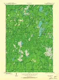
~ Pike Lake WI topo map, 1:48000 scale, 15 X 15 Minute, Historical, 1941, updated 1961
Pike Lake, Wisconsin, USGS topographic map dated 1941.
Includes geographic coordinates (latitude and longitude). This topographic map is suitable for hiking, camping, and exploring, or framing it as a wall map.
Printed on-demand using high resolution imagery, on heavy weight and acid free paper, or alternatively on a variety of synthetic materials.
Topos available on paper, Waterproof, Poly, or Tyvek. Usually shipping rolled, unless combined with other folded maps in one order.
- Product Number: USGS-5999916
- Free digital map download (high-resolution, GeoPDF): Pike Lake, Wisconsin (file size: 6 MB)
- Map Size: please refer to the dimensions of the GeoPDF map above
- Weight (paper map): ca. 55 grams
- Map Type: POD USGS Topographic Map
- Map Series: HTMC
- Map Verison: Historical
- Cell ID: 60986
- Scan ID: 802963
- Imprint Year: 1961
- Woodland Tint: Yes
- Field Check Year: 1941
- Datum: NAD27
- Map Projection: Polyconic
- Planimetric: Yes
- Map published by United States Geological Survey
- Map Language: English
- Scanner Resolution: 508 dpi
- Map Cell Name: Pike Lake
- Grid size: 15 X 15 Minute
- Date on map: 1941
- Map Scale: 1:48000
- Geographical region: Wisconsin, United States
Neighboring Maps:
All neighboring USGS topo maps are available for sale online at a variety of scales.
Spatial coverage:
Topo map Pike Lake, Wisconsin, covers the geographical area associated the following places:
- Whitcomb Lake - Stony Creek - Spring Creek - McArthur Lake - Bass Lake Preserve State Natural Area - Pine Creek - Robert Sells 3WR814 Dam - Jupa Lake - Cochran Lake - Beaver Creek - Wabasso Lake - Sentinal Point Lookout Tower - Oles Lake - Tucker Lake - Grant Spring - Cedar Rapids - Town of Fifield - Cochran Creek - Amik Lake - Foulds Creek - Turner Lake - Tackle Lake - Fishtrap Campground - Shady Knoll School (historical) - Penny Lake - Sieverson Spring - Newman Lake - Smith Rapids - Newman Lake Recreation Area - South Fork Fire Tower (historical) - Round Lake - Riley Creek - Rice Lake Creek - Foulds Springs - Pike Lake Fire Department - Riley Creek Forest Service Station - Kabol Lake - Newman Springs Ski Trail - Spring Creek - Bootjack Lake - Miles Lake - Camp C Creek - Newman Creek - Rice Lake - Four Corners Camp Ground (historical) - Caro Timber Picnic Ground (historical) - Riley Lake Wildlife Management Area - Byhre Lake - Little Cedar Rapids - Little Pine Creek - Twin Lakes - Duck Lake - Elk River Lookout Tower - Pond Lake - Springstead Airport - Ferry Springs - Camp Nine Springs - Tucker Lake Hemlocks State Natural Area - Spring Branch - Rice Creek - Sieverson Creek - Squaw Creek - Riley Lake - Memorial Grove Hemlocks State Natural Area - Twin Lakes Campground - Townline Lake - South Lake - Island Lake - Memorial Grove Picnic Area - Emily Creek - Wilson Flowage - Byhre Creek - Patterson Lake - Big Pine Lake - Willow Springs - Springstead Creek - Mud Lake - Tucker Creek - Thompson Lake - Elevenmile Creek - Thompson Creek - Marty Lake - Smith River Campground - Hemlock Grove Camp (historical) - Willow Springs Camp Ground (historical) - Clover Creek - Franks Seaplane Base - Apeekwa Lake - Robert Sells Flowage 1 - Quimette Lake - Emily Lake - Pike Lake - Deer Lake - Camp Four Springs - Newman Springs - Nettie B Lake - Emily Lake Campground
- Map Area ID: AREA4645.75-90.25-90
- Northwest corner Lat/Long code: USGSNW46-90.25
- Northeast corner Lat/Long code: USGSNE46-90
- Southwest corner Lat/Long code: USGSSW45.75-90.25
- Southeast corner Lat/Long code: USGSSE45.75-90
- Northern map edge Latitude: 46
- Southern map edge Latitude: 45.75
- Western map edge Longitude: -90.25
- Eastern map edge Longitude: -90


