
~ Eau Claire WI topo map, 1:250000 scale, 1 X 2 Degree, Historical, 1958
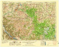
Eau Claire, Wisconsin, USGS topographic map dated 1958.
Includes geographic coordinates (latitude and longitude). This topographic map is suitable for hiking, camping, and exploring, or framing it as a wall map.
Printed on-demand using high resolution imagery, on heavy weight and acid free paper, or alternatively on a variety of synthetic materials.
Topos available on paper, Waterproof, Poly, or Tyvek. Usually shipping rolled, unless combined with other folded maps in one order.
- Product Number: USGS-5997860
- Free digital map download (high-resolution, GeoPDF): Eau Claire, Wisconsin (file size: 11 MB)
- Map Size: please refer to the dimensions of the GeoPDF map above
- Weight (paper map): ca. 55 grams
- Map Type: POD USGS Topographic Map
- Map Series: HTMC
- Map Verison: Historical
- Cell ID: 68763
- Scan ID: 801534
- Woodland Tint: Yes
- Aerial Photo Year: 1953
- Field Check Year: 1953
- Datum: Unstated
- Map Projection: Transverse Mercator
- Map published by United States Geological Survey
- Map Language: English
- Scanner Resolution: 508 dpi
- Map Cell Name: Eau Claire
- Grid size: 1 X 2 Degree
- Date on map: 1958
- Map Scale: 1:250000
- Geographical region: Wisconsin, United States
Neighboring Maps:
All neighboring USGS topo maps are available for sale online at a variety of scales.
Spatial coverage:
Topo map Eau Claire, Wisconsin, covers the geographical area associated the following places:
- Hillcrest Estates Mobile Home Park - Caryville - Durand - Granton - Bohri (historical) - Brackett - Arpin - Laneville - Owen - Weaver - Marshland - Stockton - Willard - Terrace Hill - New Miner - Norway Ridge - Cedar Falls - Shennington - Cutler - Hixton - Fall Creek - Weber - Marshfield - Arcadia - Stratford - Valley Junction - East Winona - Longwood - Green Acres - Downsville - Loyal - Chippewa Falls - Rodell - Charter Oak Mills (historical) - Pine Edge Mobile Home Park - Upper French Creek - Boyd - Countryside Manor Mobile Home Park - Vaudreuil - Modena - Wrights Corners - Stanley - Praag - Ettrick - Waterbury - Bright - Wuertsburg - Levis - Ludington - Wilson - Blair - Huber Mobile Home Park - Milan - Old Tyrone (historical) - Butman Corners - North Tomah - Price - Fountain City - Shawtown - Homer - Centerville - Altura - Alma Center - Franklin - Camino Mobile Home Park - Herold - Nelsonville (historical) - Withee - Tarrant - McMillan - Pine Creek (historical) - Seymour - Villa Diann Mobile Home Park - Spokeville - Czechville - Dewey Corners - York - Allen - Lombard - Glencoe - Finley - Falls City - Fall Hall Glen - Old Albertville - Rozellville - Warrens - Chapultepee - Oakridge - Veefkind - Beachs Corners - Shamrock - Springdale (historical) - Whitman - Wrightsville (historical) - Necedah - Black River Falls - Pine Grove - Northfield - Swan - Little Rose
- Map Area ID: AREA4544-92-90
- Northwest corner Lat/Long code: USGSNW45-92
- Northeast corner Lat/Long code: USGSNE45-90
- Southwest corner Lat/Long code: USGSSW44-92
- Southeast corner Lat/Long code: USGSSE44-90
- Northern map edge Latitude: 45
- Southern map edge Latitude: 44
- Western map edge Longitude: -92
- Eastern map edge Longitude: -90


