
~ Eau Claire WI topo map, 1:250000 scale, 1 X 2 Degree, Historical, 1953, updated 1965
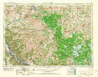
Eau Claire, Wisconsin, USGS topographic map dated 1953.
Includes geographic coordinates (latitude and longitude). This topographic map is suitable for hiking, camping, and exploring, or framing it as a wall map.
Printed on-demand using high resolution imagery, on heavy weight and acid free paper, or alternatively on a variety of synthetic materials.
Topos available on paper, Waterproof, Poly, or Tyvek. Usually shipping rolled, unless combined with other folded maps in one order.
- Product Number: USGS-5997856
- Free digital map download (high-resolution, GeoPDF): Eau Claire, Wisconsin (file size: 11 MB)
- Map Size: please refer to the dimensions of the GeoPDF map above
- Weight (paper map): ca. 55 grams
- Map Type: POD USGS Topographic Map
- Map Series: HTMC
- Map Verison: Historical
- Cell ID: 68763
- Scan ID: 801532
- Imprint Year: 1965
- Woodland Tint: Yes
- Aerial Photo Year: 1953
- Field Check Year: 1953
- Datum: Unstated
- Map Projection: Transverse Mercator
- Map published by United States Geological Survey
- Map Language: English
- Scanner Resolution: 508 dpi
- Map Cell Name: Eau Claire
- Grid size: 1 X 2 Degree
- Date on map: 1953
- Map Scale: 1:250000
- Geographical region: Wisconsin, United States
Neighboring Maps:
All neighboring USGS topo maps are available for sale online at a variety of scales.
Spatial coverage:
Topo map Eau Claire, Wisconsin, covers the geographical area associated the following places:
- Hallie - Green Acres - Cataract - Valley Junction - West Prairie - Bright - Arpin - Curtiss - Fountain City - Loyal - New City (historical) - Veedum - Humbird - Abbotsford - Price - Maples Mobile Home Park - Bohri (historical) - Rozellville - Cochrane - Bradley - Sugarloaf - Hale Corner - Lindsey - Council Bay - Wrights Corners - Urne - Ludington - Albertville - Shennington - Wien - Lapham Junction - Wyeville - Upper French Creek - Norway Ridge - Hatfield - Downsville - Cortland (historical) - Pigeon Falls - Babcock - Hixton - Cutler - Worden (historical) - Pray - Cranmoor - Eleva - Longwood - Unity - Bakerville - Rock Falls - Durand - Chapultepee - Pittsville - Atwood - Staadts (historical) - Riplinger - Coral City - Beachs Corners - Rodell - Rollingstone - Homer - Lima - Foster - Herold - Stanley - Morningside Terrace - Spaulding - Buffalo City - Pleasantville - York - Millston - Pine Creek - Elk Creek - Globe - Sechlerville - Norma - Mindoro - Countryside Manor Mobile Home Park - Altoona - Czechville - Nix Corner - Milan - Dewey Corners - Mather - Colby - Colfax - Willard - Dodge - Shawtown - Tainter Lake - March Rapids - Bateman - Springdale (historical) - Pine Creek (historical) - Wilson - Minnesota City - Rogneys (historical) - Brockway - Montana - Irvington - Glencoe
- Map Area ID: AREA4544-92-90
- Northwest corner Lat/Long code: USGSNW45-92
- Northeast corner Lat/Long code: USGSNE45-90
- Southwest corner Lat/Long code: USGSSW44-92
- Southeast corner Lat/Long code: USGSSE44-90
- Northern map edge Latitude: 45
- Southern map edge Latitude: 44
- Western map edge Longitude: -92
- Eastern map edge Longitude: -90


