
~ Eau Claire WI topo map, 1:250000 scale, 1 X 2 Degree, Historical, 1953, updated 1978
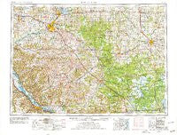
Eau Claire, Wisconsin, USGS topographic map dated 1953.
Includes geographic coordinates (latitude and longitude). This topographic map is suitable for hiking, camping, and exploring, or framing it as a wall map.
Printed on-demand using high resolution imagery, on heavy weight and acid free paper, or alternatively on a variety of synthetic materials.
Topos available on paper, Waterproof, Poly, or Tyvek. Usually shipping rolled, unless combined with other folded maps in one order.
- Product Number: USGS-5997854
- Free digital map download (high-resolution, GeoPDF): Eau Claire, Wisconsin (file size: 13 MB)
- Map Size: please refer to the dimensions of the GeoPDF map above
- Weight (paper map): ca. 55 grams
- Map Type: POD USGS Topographic Map
- Map Series: HTMC
- Map Verison: Historical
- Cell ID: 68763
- Scan ID: 801530
- Imprint Year: 1978
- Woodland Tint: Yes
- Aerial Photo Year: 1976
- Edit Year: 1977
- Field Check Year: 1953
- Datum: Unstated
- Map Projection: Transverse Mercator
- Map published by United States Geological Survey
- Map published by United States Army Corps of Engineers
- Map Language: English
- Scanner Resolution: 508 dpi
- Map Cell Name: Eau Claire
- Grid size: 1 X 2 Degree
- Date on map: 1953
- Map Scale: 1:250000
- Geographical region: Wisconsin, United States
Neighboring Maps:
All neighboring USGS topo maps are available for sale online at a variety of scales.
Spatial coverage:
Topo map Eau Claire, Wisconsin, covers the geographical area associated the following places:
- Requa - Minnesota City - Falls City - Albertville - Curtiss - Chili - Atwood - Tarrant - Ludington - Oakridge - Nix Corner - Minneiska - Cloverdale - Hidden Valley Mobile Home Village - Veefkind - Glencoe - Tioga - Spring Bank Park - Loyal - Abbotsford - Pinehurst - Wuertsburg - Buffalo City - Babcock - Berghs Mobile Home Park - Warrens - Stevenstown - Lake Wissota - Praag - Brackett - Fall Creek - Nelsonville (historical) - East Winona - Sechlerville - Whitman - Tunnel City - Humbird - Colby - Staadts (historical) - Hillcrest Estates Mobile Home Park - Millston - Menominee - Hale - Worden (historical) - Price - Cherokee - Cutler - March Rapids - Elk Creek - Thorp - Whitehall - Elk Mound - Wilson - Norway Ridge - Cream - Oak Ridge Village Mobile Home Park - Eau Claire - Pine Creek - Tell - Spaulding - Stockton - Russell - Fountain City - Nasonville - Terrace Hill - Alma - Edson - McMillan - Stanley - Huber Mobile Home Park - Osseo - Sherwood - Hatfield - Lake Hallie - Goodview - Truax - Centerville - Pray - Rusk - Galesville - Strum - Franklin - Tamarack - Pittsville - Finley - Irving - Czechville - Mondovi - Pine Grove - Withee - Waterbury - Milan - Menomonie Junction - Colfax - Unity - Dexterville - Wyeville - Altura - Burr Oak - Meadow Valley
- Map Area ID: AREA4544-92-90
- Northwest corner Lat/Long code: USGSNW45-92
- Northeast corner Lat/Long code: USGSNE45-90
- Southwest corner Lat/Long code: USGSSW44-92
- Southeast corner Lat/Long code: USGSSE44-90
- Northern map edge Latitude: 45
- Southern map edge Latitude: 44
- Western map edge Longitude: -92
- Eastern map edge Longitude: -90


