
~ Eau Claire WI topo map, 1:250000 scale, 1 X 2 Degree, Historical, 1953, updated 1978
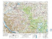
Eau Claire, Wisconsin, USGS topographic map dated 1953.
Includes geographic coordinates (latitude and longitude). This topographic map is suitable for hiking, camping, and exploring, or framing it as a wall map.
Printed on-demand using high resolution imagery, on heavy weight and acid free paper, or alternatively on a variety of synthetic materials.
Topos available on paper, Waterproof, Poly, or Tyvek. Usually shipping rolled, unless combined with other folded maps in one order.
- Product Number: USGS-5997852
- Free digital map download (high-resolution, GeoPDF): Eau Claire, Wisconsin (file size: 14 MB)
- Map Size: please refer to the dimensions of the GeoPDF map above
- Weight (paper map): ca. 55 grams
- Map Type: POD USGS Topographic Map
- Map Series: HTMC
- Map Verison: Historical
- Cell ID: 68763
- Scan ID: 503713
- Imprint Year: 1978
- Woodland Tint: Yes
- Visual Version Number: 2
- Aerial Photo Year: 1976
- Edit Year: 1977
- Field Check Year: 1953
- Datum: NAD27
- Map Projection: Transverse Mercator
- Map published by: Military, Other
- Map Language: English
- Scanner Resolution: 508 dpi
- Map Cell Name: Eau Claire
- Grid size: 1 X 2 Degree
- Date on map: 1953
- Map Scale: 1:250000
- Geographical region: Wisconsin, United States
Neighboring Maps:
All neighboring USGS topo maps are available for sale online at a variety of scales.
Spatial coverage:
Topo map Eau Claire, Wisconsin, covers the geographical area associated the following places:
- Disco - Kellogg - Kirby - Mann - Lake Wissota - Franklin - Anson - Sheppard - Homer - Hay Creek - Wien - Waumandee - Meridean - Goodview - Stockton - Elk Creek - Whitehall - Bohri (historical) - Kurth (historical) - Melrose - Spaulding - Coral City - Nevins - Hale Corner - Centerville - Northfield - Durand - Veefkind - Williamsburg (historical) - Reseburg - Fall Creek - Morningside Terrace - Gilmanton - Winona - Bakerville - Boyd - Caryville - Springdale (historical) - Seymour - Stevenstown - Colfax - Owen - Tioga - Arcadia - Putnam Heights - Cherokee - Lynn - Pine Creek - Hewitt - Nix Corner - Bateman - Willard - Pine Creek (historical) - Wrightsville (historical) - Hegg - Marshfield - Mather - Pine Grove - Merrillan - Clay (historical) - Albertville - Altura - Minnesota City - North Tomah - Eleva - Cortland (historical) - Rusk - Nelsonville (historical) - Cataract - Cream - Brackett - Ludington - Humbird - Eau Claire - Glencoe - Irvine - Oakridge - Lookout - Buffalo City - Terrace Hill - Pine Edge Mobile Home Park - Rodell - Augusta - Downsville - Spokeville - Laneville - Old Albertville - Rock Falls - Mount Hope Corners - Little Rose - Bright - Veedum - Camino Mobile Home Park - Irving - Norway Ridge - Wyeville - West Prairie - City Point - Altoona - Millston
- Map Area ID: AREA4544-92-90
- Northwest corner Lat/Long code: USGSNW45-92
- Northeast corner Lat/Long code: USGSNE45-90
- Southwest corner Lat/Long code: USGSSW44-92
- Southeast corner Lat/Long code: USGSSE44-90
- Northern map edge Latitude: 45
- Southern map edge Latitude: 44
- Western map edge Longitude: -92
- Eastern map edge Longitude: -90


