
~ Eagle River West WI topo map, 1:24000 scale, 7.5 X 7.5 Minute, Historical, 1970, updated 1982
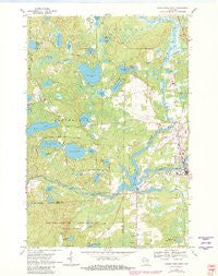
Eagle River West, Wisconsin, USGS topographic map dated 1970.
Includes geographic coordinates (latitude and longitude). This topographic map is suitable for hiking, camping, and exploring, or framing it as a wall map.
Printed on-demand using high resolution imagery, on heavy weight and acid free paper, or alternatively on a variety of synthetic materials.
Topos available on paper, Waterproof, Poly, or Tyvek. Usually shipping rolled, unless combined with other folded maps in one order.
- Product Number: USGS-5997802
- Free digital map download (high-resolution, GeoPDF): Eagle River West, Wisconsin (file size: 11 MB)
- Map Size: please refer to the dimensions of the GeoPDF map above
- Weight (paper map): ca. 55 grams
- Map Type: POD USGS Topographic Map
- Map Series: HTMC
- Map Verison: Historical
- Cell ID: 13276
- Scan ID: 500365
- Imprint Year: 1982
- Woodland Tint: Yes
- Photo Revision Year: 1982
- Aerial Photo Year: 1980
- Edit Year: 1982
- Field Check Year: 1970
- Datum: NAD27
- Map Projection: Polyconic
- Map published by United States Geological Survey
- Map Language: English
- Scanner Resolution: 508 dpi
- Map Cell Name: Eagle River West
- Grid size: 7.5 X 7.5 Minute
- Date on map: 1970
- Map Scale: 1:24000
- Geographical region: Wisconsin, United States
Neighboring Maps:
All neighboring USGS topo maps are available for sale online at a variety of scales.
Spatial coverage:
Topo map Eagle River West, Wisconsin, covers the geographical area associated the following places:
- Bullfrog Lake - Rice Lake - Tepee Lake - Nelson Lake - Perch Lake School (historical) - Watersmeet Lake - Bohemian School (historical) - Eagle River Union Airport - Eagle River Memorial Hospital - Northland Pines Elementary School Eagle River - Brazell Creek - Adams Lake - Croker Lake - Lotus Lake - Frost Lake - Muskellunge School (historical) - Lake Aidenn - Sucker Creek - Eagle River Village Hall - Vilas County Sheriff's Office - Eagle River - Snipe Lake - Otter Rapids 1905c483 Dam - Tellefson Lake - Boot Lake School (historical) - Range Line Lake - Pickerel Creek - Mud Creek - Watersmeet Lake 533 - Brazell Lake - Lake Mary - Little Pine Lake - Chickaree Lake - City of Eagle River - Otter Rapids Golf Course - Otter Rapids Dam - Northland Pines Middle School - Northland Pines High School - Perch Lake - Sunset Lake - Seneca Lake - Walter E Olson Memorial Library - Travel Care International - Deep Lake - Cooks Lake - Boot Lake - Town of Cloverland - Vilas County Courthouse - Honeysuckle Lake - Rice Creek - McLeod Lake - Crocker School (historical) - Mud Lake - Boot Creek - Vilas County Jail - Mud Minnow Lake
- Map Area ID: AREA4645.875-89.375-89.25
- Northwest corner Lat/Long code: USGSNW46-89.375
- Northeast corner Lat/Long code: USGSNE46-89.25
- Southwest corner Lat/Long code: USGSSW45.875-89.375
- Southeast corner Lat/Long code: USGSSE45.875-89.25
- Northern map edge Latitude: 46
- Southern map edge Latitude: 45.875
- Western map edge Longitude: -89.375
- Eastern map edge Longitude: -89.25


