
~ Chain Lake WI topo map, 1:24000 scale, 7.5 X 7.5 Minute, Historical, 1972, updated 1974
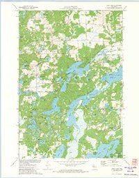
Chain Lake, Wisconsin, USGS topographic map dated 1972.
Includes geographic coordinates (latitude and longitude). This topographic map is suitable for hiking, camping, and exploring, or framing it as a wall map.
Printed on-demand using high resolution imagery, on heavy weight and acid free paper, or alternatively on a variety of synthetic materials.
Topos available on paper, Waterproof, Poly, or Tyvek. Usually shipping rolled, unless combined with other folded maps in one order.
- Product Number: USGS-5997478
- Free digital map download (high-resolution, GeoPDF): Chain Lake, Wisconsin (file size: 9 MB)
- Map Size: please refer to the dimensions of the GeoPDF map above
- Weight (paper map): ca. 55 grams
- Map Type: POD USGS Topographic Map
- Map Series: HTMC
- Map Verison: Historical
- Cell ID: 8057
- Scan ID: 500250
- Imprint Year: 1974
- Woodland Tint: Yes
- Aerial Photo Year: 1971
- Field Check Year: 1972
- Datum: NAD27
- Map Projection: Lambert Conformal Conic
- Map published by United States Geological Survey
- Map Language: English
- Scanner Resolution: 508 dpi
- Map Cell Name: Chain Lake
- Grid size: 7.5 X 7.5 Minute
- Date on map: 1972
- Map Scale: 1:24000
- Geographical region: Wisconsin, United States
Neighboring Maps:
All neighboring USGS topo maps are available for sale online at a variety of scales.
Spatial coverage:
Topo map Chain Lake, Wisconsin, covers the geographical area associated the following places:
- Leo Joerg Lake - McCann Lake - Clear Lake - Pine Lake - Granger Lake - Tamarack Lake - Rusk Lake - Cedar Creek - McDonald Lake - Lake Three - Atwood Lake - Chick Lake - Cedar Creek - Lost Lake - Muskrat Lake - Potato Creek State Wildlife Management Area - Sugar Lake - Cather Lake - Hungry Lake - MacDonald Lake - North Cummings Lake - Silver Lake - Two Bear Camp - Chain Lake School (historical) - Camp Wahdoon - Axhandle Lake - Dickey Lake - Bear Lake School (historical) - Bass Lake - Town of Rusk - Little Bass Lake - North Lima School (historical) - Round Lake - Potato Lake - Lake Two - Little Pine Lake - Ruby Lake - Long Lake School (historical) - Calkins Lake - Long Lake - Turk Lake - Rock Lake - Jacks Lake - Dark Lake - Rusk Townhall - Dead Goose Lake - Brush Lake - Whiplash Lake - The Narrows - Star Lake - Cadotte Lake - South Cummings Lake - Coon Lake - Mathy Lake - Lake One - Bear Lake - Galky Lake - McDermott Creek - Beauty Lake - Bear Lake - Two Bear Lake - Potato Creek Flowage - Stang Lookout Tower - Chain Lake - Morris-Erickson County Park - Hogskin Lake - Schoolhouse Lake - Little Bear Lake - Rusk Farm School (historical) - Lake Four
- Map Area ID: AREA45.37545.25-91.5-91.375
- Northwest corner Lat/Long code: USGSNW45.375-91.5
- Northeast corner Lat/Long code: USGSNE45.375-91.375
- Southwest corner Lat/Long code: USGSSW45.25-91.5
- Southeast corner Lat/Long code: USGSSE45.25-91.375
- Northern map edge Latitude: 45.375
- Southern map edge Latitude: 45.25
- Western map edge Longitude: -91.5
- Eastern map edge Longitude: -91.375


