
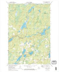
~ Blaisdell Lake WI topo map, 1:24000 scale, 7.5 X 7.5 Minute, Historical, 1971, updated 1973
Blaisdell Lake, Wisconsin, USGS topographic map dated 1971.
Includes geographic coordinates (latitude and longitude). This topographic map is suitable for hiking, camping, and exploring, or framing it as a wall map.
Printed on-demand using high resolution imagery, on heavy weight and acid free paper, or alternatively on a variety of synthetic materials.
Topos available on paper, Waterproof, Poly, or Tyvek. Usually shipping rolled, unless combined with other folded maps in one order.
- Product Number: USGS-5997318
- Free digital map download (high-resolution, GeoPDF): Blaisdell Lake, Wisconsin (file size: 10 MB)
- Map Size: please refer to the dimensions of the GeoPDF map above
- Weight (paper map): ca. 55 grams
- Map Type: POD USGS Topographic Map
- Map Series: HTMC
- Map Verison: Historical
- Cell ID: 4315
- Scan ID: 800303
- Imprint Year: 1973
- Woodland Tint: Yes
- Aerial Photo Year: 1969
- Field Check Year: 1971
- Datum: NAD27
- Map Projection: Polyconic
- Map published by United States Geological Survey
- Map Language: English
- Scanner Resolution: 508 dpi
- Map Cell Name: Blaisdell Lake
- Grid size: 7.5 X 7.5 Minute
- Date on map: 1971
- Map Scale: 1:24000
- Geographical region: Wisconsin, United States
Neighboring Maps:
All neighboring USGS topo maps are available for sale online at a variety of scales.
Spatial coverage:
Topo map Blaisdell Lake, Wisconsin, covers the geographical area associated the following places:
- Thompson Pit - Glenwood Camp - Black Lake - Winter 2WP806 Dam - Black Lake Trail - Kocmoud Lake - Snoose Lake - Black Lake Fire Tower (historical) - Mud Lake - Fishtrap Lake - Hunter Lake - Black Dan Lake - Black Lake Dam - Fishtrap Lake Dam - Island Lake - Blue Gill Lake - Fishtrap Lake 161 - Perch Lake - Loretta Lake - Upper Brunet 2 WP 400 Dam - Black Lake Campground - We Ha Kee Church Camp - Barber Lake School (historical) - Brunet Flowage 30 - 235 Reservoir - Snoose Creek - Fishtrap Creek - Snag Lake - Blaisdell Lake - Black Lake 4 - Barber Lake
- Map Area ID: AREA4645.875-91-90.875
- Northwest corner Lat/Long code: USGSNW46-91
- Northeast corner Lat/Long code: USGSNE46-90.875
- Southwest corner Lat/Long code: USGSSW45.875-91
- Southeast corner Lat/Long code: USGSSE45.875-90.875
- Northern map edge Latitude: 46
- Southern map edge Latitude: 45.875
- Western map edge Longitude: -91
- Eastern map edge Longitude: -90.875


