
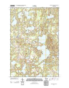
~ McKenzie Lake WI topo map, 1:24000 scale, 7.5 X 7.5 Minute, Historical, 2013
McKenzie Lake, Wisconsin, USGS topographic map dated 2013.
Includes geographic coordinates (latitude and longitude). This topographic map is suitable for hiking, camping, and exploring, or framing it as a wall map.
Printed on-demand using high resolution imagery, on heavy weight and acid free paper, or alternatively on a variety of synthetic materials.
Topos available on paper, Waterproof, Poly, or Tyvek. Usually shipping rolled, unless combined with other folded maps in one order.
- Product Number: USGS-5955703
- Free digital map download (high-resolution, GeoPDF): McKenzie Lake, Wisconsin (file size: 29 MB)
- Map Size: please refer to the dimensions of the GeoPDF map above
- Weight (paper map): ca. 55 grams
- Map Type: POD USGS Topographic Map
- Map Series: US Topo
- Map Verison: Historical
- Cell ID: 28443
- Datum: North American Datum of 1983
- Map Projection: Transverse Mercator
- Map Cell Name: McKenzie Lake
- Grid size: 7.5 X 7.5 Minute
- Date on map: 2013
- Map Scale: 1:24000
- Geographical region: Wisconsin, United States
Neighboring Maps:
All neighboring USGS topo maps are available for sale online at a variety of scales.
Spatial coverage:
Topo map McKenzie Lake, Wisconsin, covers the geographical area associated the following places:
- Lake 36 16 - Dubois Lake - Goose Lake - Lindy Lake - McKenzie Lake - Alpha Hotel Airport - Crescent Lake - South Midwest Cranberry Company WP99 Dam - Nicaboyne Lake - Cranberry Lake - Fish Lake - Scott Townhall - North Midwest Cranberry Company WP99 Dam - Rooney Lake - Deer Lake - Little Bass Lake - Perch Lake - Sacred Hearts Cemetery - Gaslyn Lake - Wilkerson Lake - Sacred Hearts Church - Middle McKenzie Lake - Mystery Lake - Lily Lake - Lower McKenzie Lake - Clubhouse Lake - Scott School - Behr Lake - Lost Lake - Benoit Lake - Town of Scott - Scott Township Volunteer Fire Department - Eagle Lake - Gaslyn Creek School - McKenzie Lake Lookout Tower - Smith Lake - Deep Lake - Durand Lake
- Map Area ID: AREA4645.875-92.125-92
- Northwest corner Lat/Long code: USGSNW46-92.125
- Northeast corner Lat/Long code: USGSNE46-92
- Southwest corner Lat/Long code: USGSSW45.875-92.125
- Southeast corner Lat/Long code: USGSSE45.875-92
- Northern map edge Latitude: 46
- Southern map edge Latitude: 45.875
- Western map edge Longitude: -92.125
- Eastern map edge Longitude: -92


