
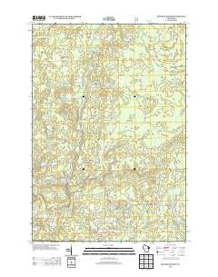
~ Roaring Rapids WI topo map, 1:24000 scale, 7.5 X 7.5 Minute, Historical, 2013
Roaring Rapids, Wisconsin, USGS topographic map dated 2013.
Includes geographic coordinates (latitude and longitude). This topographic map is suitable for hiking, camping, and exploring, or framing it as a wall map.
Printed on-demand using high resolution imagery, on heavy weight and acid free paper, or alternatively on a variety of synthetic materials.
Topos available on paper, Waterproof, Poly, or Tyvek. Usually shipping rolled, unless combined with other folded maps in one order.
- Product Number: USGS-5954701
- Free digital map download (high-resolution, GeoPDF): Roaring Rapids, Wisconsin (file size: 36 MB)
- Map Size: please refer to the dimensions of the GeoPDF map above
- Weight (paper map): ca. 55 grams
- Map Type: POD USGS Topographic Map
- Map Series: US Topo
- Map Verison: Historical
- Cell ID: 38101
- Datum: North American Datum of 1983
- Map Projection: Transverse Mercator
- Map Cell Name: Roaring Rapids
- Grid size: 7.5 X 7.5 Minute
- Date on map: 2013
- Map Scale: 1:24000
- Geographical region: Wisconsin, United States
Neighboring Maps:
All neighboring USGS topo maps are available for sale online at a variety of scales.
Spatial coverage:
Topo map Roaring Rapids, Wisconsin, covers the geographical area associated the following places:
- Wilson Rapids - Rooney Lake - Three Little Lakes - Babson Pond - Hoyle and Johnson 3WR-1647 Dam - Brandywine Lake - Camp Five Creek - Brandywine Creek - Swamp Creek - Shady Nook School (historical) - Homestead Creek - Rat River - Campbell Lake - Town of Silver Cliff - Marinette County Beech Forest State Natural Area - Roaring Rapids - Silver Cliff Volunteer Fire Department - Mc Clintock County Park - Saint Mary of the Cliff Church - Crandall Lake - Jerry Chute - Homestead Lake - Taylor Lake - Campbell Creek - Otter Creek
- Map Area ID: AREA45.545.375-88.375-88.25
- Northwest corner Lat/Long code: USGSNW45.5-88.375
- Northeast corner Lat/Long code: USGSNE45.5-88.25
- Southwest corner Lat/Long code: USGSSW45.375-88.375
- Southeast corner Lat/Long code: USGSSE45.375-88.25
- Northern map edge Latitude: 45.5
- Southern map edge Latitude: 45.375
- Western map edge Longitude: -88.375
- Eastern map edge Longitude: -88.25


